Saguaro National Park: Trails, Maps, Fees & Visitor Guide
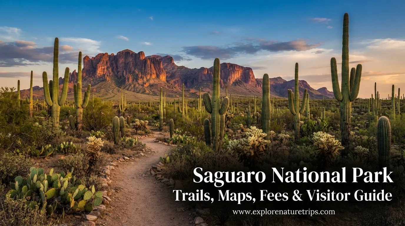
Saguaro National Park is a remarkable desert landscape surrounding Tucson, Arizona, where enormous saguaro cacti rise above the Sonoran Desert. The park is divided into two districts: the Rincon Mountain District east of Tucson and the Tucson Mountain District west of the city.
The two sides offer different experiences. The West District is especially appealing for visitors who want dense cactus forests, scenic drives, petroglyphs, overlooks, and relatively accessible trails. The East District provides higher mountain terrain, longer trails, and better opportunities for backcountry adventures.
The park covers 91,327 acres, while the Rincon Mountain District rises to more than 8,000 feet and contains more than 128 miles of trails.
East and West Districts: Which Side Should You Visit?
One of the most important things to understand before arriving is that Saguaro National Park is not one compact area.
The Tucson Mountain District is approximately 30 minutes west of Tucson, while the Rincon Mountain District is approximately 30 minutes east. There is no direct road connecting the two park districts, so visitors should plan their route rather than assuming they can easily drive from one side to the other.
| District | Best For | Approx. From Tucson |
|---|---|---|
| West / Tucson Mountain District | Cactus forests, petroglyphs, sunsets, short hikes | 25–30 min |
| East / Rincon Mountain District | Mountains, longer trails, backcountry hiking | 30 min |
If you only have a few hours, the West District offers an efficient introduction to the park because several highlights are close together.
If you have 2 days, consider giving one day to each district. This allows enough time for scenic drives, overlooks, short hikes, and stops without rushing.
When Is the Best Time to Visit?
The desert climate should influence your itinerary.
The most comfortable general visiting period is November through April, when temperatures are more suitable for hiking and sightseeing. March and April can be especially attractive because wildflowers and cactus blossoms may appear.
Summer is considerably more demanding. Temperatures frequently rise above 100°F, and one source records a period of more than 40 consecutive days above 100°F.
| Season | What to Expect |
|---|---|
| November–February | Cooler hiking conditions |
| March–April | Wildflowers and cactus blossoms |
| Late April–June | Saguaro flowering period |
| July–September | Hot conditions and monsoon weather |
| June–September | Often 100°F+ during the day |
If hiking is your main goal, starting early in the day is especially important during warmer months.
How Much Time Do You Need?
A short visit can cover several highlights, but 1–2 days gives you considerably more flexibility.
For a one-day trip, concentrate on one district rather than spending most of the day driving between the two sides.
A two-day itinerary is more comfortable:
- Day 1: West District
- Day 2: East District
This approach also gives you more opportunities to stop at viewpoints, visitor centers, scenic drives, and shorter trails. Pines & Vines specifically recommends 1–2 days for visiting the park.
Best Things to Do in the West District
The West District, officially the Tucson Mountain District, combines dense saguaro forests with accessible trails and historic rock art.
Visit Red Hills Visitor Center
The Red Hills Visitor Center is a practical starting point. Visitors can obtain information, learn about desert ecology, and prepare for their drive or hike.
The nearby Desert Discovery Trail is only 0.4 miles and is paved and relatively flat, making it useful for visitors looking for an easy introduction to the Sonoran Desert.
Drive the Bajada Scenic Loop
The Bajada Scenic Loop covers approximately 5 miles.
The unpaved road connects hiking areas, picnic locations, viewpoints, and the Signal Hill area. It can be driven or biked, although visitors should remember that bicycles are restricted to the road rather than the connecting hiking trails.
The loop is particularly useful when time is limited because you can experience a large cactus landscape without committing to a long hike.
See the Signal Hill Petroglyphs
Signal Hill contains approximately 200 petroglyphs.
The rock art is associated with the Hohokam, who occupied the region between approximately 450 and 1450 AD. The carvings include human figures, animals, and abstract forms. Visitors should observe the artwork without touching it because contact can damage the rock surface.
Best West District Hikes
| Trail | Distance | Difficulty | Key Feature |
|---|---|---|---|
| Desert Discovery Trail | 0.4 mi loop | Easy | Paved desert introduction |
| Valley View Overlook | 0.8 mi RT | Easy | Wide desert views |
| King Canyon Trail | Up to 6.9 mi RT | Moderate | Route toward Wasson Peak |
| Hugh Norris Trail | 10 mi RT | Hard | Major mountain hike |
The Valley View Overlook Trail is one of the strongest choices for a short hike. It covers only 0.8 miles round trip with minimal elevation gain and ends at a broad viewpoint.
For experienced hikers, the Hugh Norris Trail is substantially more demanding. The route is approximately 10 miles round trip with about 2,400 feet of elevation gain and reaches the area of Wasson Peak, around 5,000 feet in elevation.
Explore the East District
The Rincon Mountain District offers a different experience.
The landscape becomes more mountainous, and the district is particularly attractive for visitors interested in longer hiking routes and backcountry exploration.
The East District rises above 8,000 feet and contains more than 128 miles of trails.
Drive the Cactus Forest Loop
The Cactus Forest Loop is an approximately 8-mile paved scenic drive.
Pullouts along the route provide opportunities to stop for cactus forests, mountain views, overlooks, and short walks. Most of the route is one-way, so following the correct direction helps avoid unnecessary backtracking.
The road can also be explored by bicycle, although portions climb significantly.
Stop at Javelina Rocks
Javelina Rocks is located around mile 6 of the 8-mile Cactus Forest Loop.
The large rock formations provide an excellent place to pause and view the surrounding desert. They can also be particularly attractive around sunset.
East District Hiking Options
The East District provides options ranging from a short interpretive walk to strenuous mountain routes.
| Trail | Distance | Difficulty / Elevation |
|---|---|---|
| Desert Ecology Trail | 0.3 mi loop | Easy |
| Freeman Homestead Trail | 1 mi | Easy |
| Mica View Loop | 3.8 mi | Easy / about 100 ft gain |
| Douglas Spring to Bridal Wreath Falls | About 5.5 mi RT | Moderate |
| Tanque Verde Ridge | Up to 18 mi one-way | Strenuous |
The Desert Ecology Trail is only 0.3 miles, making it a practical choice when you want a short walk rather than a major hike.
For a longer adventure, Tanque Verde Ridge Trail can extend up to 18 miles one way, making it a serious undertaking rather than a casual sightseeing trail.
Saguaro Cactus: What Makes the Landscape Special?
The park’s namesake cactus is Carnegiea gigantea, one of the most recognizable plants of the Sonoran Desert.
Pines & Vines estimates that approximately 2 million saguaros occupy the park. The largest specimens can reach roughly 75 feet, while individual plants can survive for approximately 200 years or more.
Saguaro growth is remarkably slow. A young plant may remain only a few inches tall for its first 10 years, while the first major arm commonly appears around 50–70 years.
These numbers explain why mature saguaro forests are so valuable. What looks like an ordinary cactus landscape can actually represent generations of extremely slow growth.
Weather, Heat, and Rainfall
Saguaro National Park receives approximately 12 inches of rain annually, but precipitation is highly seasonal.
Around 4 inches typically falls between November and March, while another roughly 4 inches is associated with the summer monsoon period in July and August.
Summer heat deserves serious consideration. Visitors may encounter temperatures above 100°F, and the park has recorded periods lasting more than 40 consecutive days above that threshold.
For this reason:
- Carry sufficient water.
- Protect yourself from direct sun.
- Start strenuous hikes early.
- Avoid exposed trails during extreme heat.
- Check conditions before entering washes during monsoon weather.
- Carry a map because cell service can be limited.
Entrance Fees and Visitor Information
One lists a $25 vehicle fee valid for 7 days, while another older independent site lists $10 for an automobile, truck, or RV and $5 for walk-in or bicycle entry. Because these figures conflict, visitors should verify the current fee before traveling rather than relying on an older third-party price.
Pines & Vines also lists a $45 annual Saguaro National Park Pass.
The same older independent source lists visitor-center hours of 9:00 AM–5:00 PM, with Christmas listed as a closure day.
| Visitor Detail | Information |
|---|---|
| Vehicle pass | $25 / 7 days |
| Annual Saguaro pass | $45 |
| Visitor-center hours listed | 9 AM–5 PM |
| Park access | Listed as all year |
| Visitor-center Christmas closure | Listed by one source |
Getting to Saguaro National Park
Tucson is the most convenient base for visiting both districts.
From Tucson, the East District takes roughly 30 minutes, while the West District is approximately 25–30 minutes away depending on the route.
For air travel, Tucson International Airport (TUS) is approximately 20–30 minutes from either district. Phoenix Sky Harbor International Airport (PHX) is approximately 2 hours by car.
Because both districts are outside the central city but relatively close to Tucson, staying in the city makes it possible to visit either side without changing accommodation.
What to Pack for a Day in the Park
Desert conditions make a lightweight but thoughtful packing list important.
Bring:
- At least 2+ liters of water per person for hiking.
- Sunscreen and a hat.
- Sunglasses.
- Comfortable hiking shoes.
- Snacks or energy food.
- A downloaded map.
- Extra phone or camera battery.
- A headlamp for late hikes or stargazing.
- Layers for cooler conditions after sunset.
- A small first-aid kit.
Drinking water is particularly important because water availability is limited. Pines & Vines notes that drinking water is available at visitor centers.
A Simple 1-Day Itinerary
If you have only one day, the West District provides an efficient introduction.
Morning
Start at the Red Hills Visitor Center, then walk the 0.4-mile Desert Discovery Trail.
Late morning
Drive the 5-mile Bajada Scenic Loop, stopping at viewpoints and picnic areas.
Midday
Visit Signal Hill and see its approximately 200 petroglyphs.
Afternoon
Hike the 0.8-mile Valley View Overlook Trail.
Late afternoon
Head toward a scenic location for sunset, allowing enough time to return safely before dark.
This itinerary emphasizes shorter activities so that visitors can experience the desert without turning the day into a race between trailheads.
A Better 2-Day Plan
If you have 2 days, divide your visit between the districts.
| Day | Recommended Focus |
|---|---|
| Day 1 | West District, Bajada Loop, Signal Hill, Valley View |
| Day 2 | East District, Cactus Forest Loop, Javelina Rocks, hiking |
The second day can be adjusted according to fitness level. Casual visitors can focus on scenic drives and short trails, while experienced hikers can dedicate more time to the longer mountain routes.
Safety Tips for a Desert Visit
The scenery can look peaceful, but the environment requires preparation.
Heat: Temperatures can exceed 100°F, especially in summer.
Water: Carry enough water because facilities are limited.
Wildlife: The park is home to rattlesnakes, javelinas, coyotes, Gila monsters, and other desert wildlife.
Cacti: Avoid touching vegetation. Many plants have sharp spines even when they appear harmless.
Monsoon weather: Summer storms can produce flash flooding, particularly around washes.
Navigation: Download maps before entering areas with limited cell service.
Frequently Asked Questions
How many districts does Saguaro National Park have?
Saguaro National Park has 2 districts: the Tucson Mountain District west of Tucson and the Rincon Mountain District east of Tucson.
How big is Saguaro National Park?
The park covers approximately 91,327 acres across its two districts.
How many days should you spend at Saguaro National Park?
A 1–2 day visit works well. One day can cover the main highlights, while two days allow you to explore both districts at a more comfortable pace.
What is the best month to visit Saguaro National Park?
The park generally favors the cooler period from November through April, with March and April especially appealing for spring blooms.
How long is the Cactus Forest Loop?
The paved Cactus Forest Loop in the East District is approximately 8 miles.
How long is the Bajada Scenic Loop?
The Bajada Scenic Loop in the West District is approximately 5 miles and is primarily an unpaved scenic route.
How difficult is the Valley View Overlook Trail?
The Valley View Overlook Trail is approximately 0.8 miles round trip and is considered easy, with minimal elevation gain.
How difficult is the Hugh Norris Trail?
The Hugh Norris Trail is a hard hike of approximately 10 miles round trip with about 2,400 feet of elevation gain.
Are there petroglyphs in Saguaro National Park?
Yes. Signal Hill contains approximately 200 petroglyphs, associated with the Hohokam occupation of the area between 450 and 1450 AD.
Can you visit Saguaro National Park in summer?
Yes, but summer requires extra preparation. Temperatures can exceed 100°F, so early starts, adequate water, sun protection, and careful weather planning are especially important.
Final Planning Takeaway
Saguaro National Park is easiest to enjoy when you treat its two districts as separate experiences rather than trying to see everything in one rushed trip.
Choose the West District for dense cactus forests, Signal Hill’s petroglyphs, the Bajada Scenic Loop, and accessible viewpoints. Choose the East District for the Cactus Forest Loop, mountain scenery, and longer backcountry routes.
For most visitors, 1–2 days, cooler-season travel, early hiking starts, sufficient water, and a clear district-by-district plan provide a much more comfortable experience. The park’s combination of enormous saguaros, desert wildlife, mountain terrain, and historic cultural features makes even a short visit rewarding.

Hi, I’m Marcus! I love exploring the outdoors and discovering incredible places. Through ExploreNatureTrips blog, I share my travel experiences, useful tips, and recommendations for the best sights, trails, and destinations to visit.