
Best Hiking Trails in Utah: 20+ Epic Trails for Every Skill level
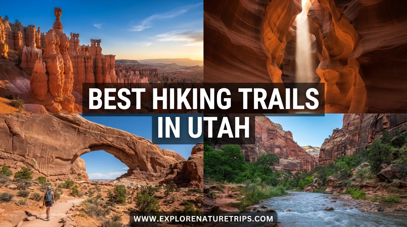
Utah is one of the best places in the United States for hikers who want dramatically different landscapes within one state. You can walk a short trail to an enormous natural arch, descend into a narrow canyon, explore red-rock formations, or spend several days on a high-elevation route.
The best hiking trails in Utah aren’t all alike. Some are less than a mile long and suitable for beginners, while others stretch beyond 70 miles and require several days, permits, careful preparation, or technical skills.
The six hiking guides reviewed for this article collectively highlight dozens of Utah trails and repeatedly emphasize the same things that matter most to hikers: distance, elevation, difficulty, access, permits, season, parking, crowds, children, and trail conditions.
To make the choices easier, this guide organizes the most useful trails by hiking style and difficulty rather than treating every trail as if it were the same.
Here you can find a full Guide about hiking trails in Utah
Best Easy Hiking Trails in Utah
Not every Utah adventure requires a long day on the trail. Several of the highlighted routes provide impressive scenery with relatively little walking, making them good starting points for beginners or hikers who simply want a shorter outing.
Double Arch
Distance: 1/4 mile
Double Arch is one of the shortest hikes in the group. At approximately 1/4 mile, it demonstrates that a Utah hiking experience doesn’t necessarily require several hours on the trail.
Its short distance makes it particularly useful when building a day around multiple attractions rather than spending the entire day on one hike.
Kanab Sand Caves
Distance: 1/4 mile
Difficulty: Easy
The Kanab Sand Caves are another example of a very short Utah adventure. The approximately 1/4-mile route makes this a useful option for travelers looking for something brief.
The major advantage of a short hike is flexibility: you can combine it with other stops without committing an entire day to one trail.
Windows & Turret Arch
Distance: 1 mile
Difficulty: Beginner
The Windows and Turret Arch route is listed at approximately 1 mile and is presented as a beginner-friendly option.
For someone building a Utah hiking itinerary around shorter walks, this type of route can be an excellent introduction to the state’s red-rock terrain.
Devils Garden
Distance: 1–2 miles
Difficulty: Beginner
Devils Garden provides another relatively short option, with the reviewed guide giving a distance of approximately 1–2 miles.
Its shorter length makes it easier to include alongside other Arches-area hikes.
Mossy Cave
Distance: 1 mile
Difficulty: Beginner
Mossy Cave is approximately 1 mile and is categorized as a beginner trail in the reviewed material.
It also appears in the family-oriented hiking research, making it particularly relevant for people who want a shorter outing.
Grand View Overlook
Distance: 2 miles
Difficulty: Beginner
At around 2 miles, Grand View Overlook is another relatively manageable route.
The attraction here is the opportunity to experience Utah’s large-scale canyon scenery without committing to one of the much longer backcountry routes.
Best Moderate Hiking Trails in Utah
Moderate hikes provide a useful middle ground. They can involve meaningful elevation, longer distances, uneven terrain, or special conditions without necessarily requiring the level of commitment associated with Utah’s most strenuous routes.
Delicate Arch
Distance: About 3–3.2 miles
Elevation gain: Approximately 480–610 feet
Difficulty: Moderate
Delicate Arch is one of the most consistently highlighted hikes across.
The reviewed sources report approximately 3 miles to 3.2 miles, with elevation figures ranging from about 480 to 610 feet.
One guide describes the trail as approximately 250 people were present during a sunset visit, illustrating an important practical consideration: popular Utah trails can become crowded at particularly desirable times.
The route is repeatedly associated with sunrise and sunset, as well as spring and fall hiking.
Corona Arch
Distance: About 3 miles
Elevation gain: Around 440 feet
Difficulty: Easy to moderate
Corona Arch appears in several of the reviewed guides.
The commonly reported figures are approximately 3 miles and 440 feet of elevation gain. One account places the trail approximately 20 minutes outside Moab, while another describes the initial approach as roughly 20–30 minutes before reaching the scramble section.
Family experience is another recurring theme. One family hiking account describes children aged 5 and 7 handling the ladder and chain sections.
That makes Corona Arch particularly interesting for families who want an adventure but should still evaluate whether ladders, chains, and scrambling are appropriate for their children.
Lower Calf Creek Falls
Distance: About 6.2–6.7 miles
Elevation gain: Around 512–550 feet
Difficulty: Easy
Lower Calf Creek Falls combines a relatively long distance with comparatively modest elevation gain.
The reviewed sources report approximately 6.2 to 6.7 miles and 512–550 feet of elevation gain.
That makes the trail a good reminder that mileage and difficulty aren’t interchangeable. A six-mile hike can feel very different from a steep six-mile route with thousands of feet of climbing.
The Wave
Distance: 5.2 miles
Elevation gain: About 400 feet
Difficulty: Moderate
The Wave is listed at approximately 5.2 miles with around 400 feet of elevation gain.
The reviewed material also emphasizes its permit system. One guide reports 64 daily permits, including 16 walk-in permits, and notes that the drive from Kanab to Wire Pass takes roughly 1 hour.
Because access is permit-dependent, this is not a trail that should be treated like an ordinary walk-up hike.
Little Wild Horse/Bell Canyon
Distance: 11.2 miles
Elevation gain: 1,617 feet
Difficulty: Moderate
At approximately 11.2 miles and 1,617 feet of elevation gain, Little Wild Horse/Bell Canyon is considerably more demanding in distance than many beginner routes.
The combination of mileage and elevation makes it more appropriate for hikers who are comfortable spending much of the day outdoors.
Best Difficult and Strenuous Hikes in Utah
Utah also offers trails where the challenge is a major part of the experience. These routes can involve substantial elevation gain, technical sections, long distances, permits, or multi-day commitments.
Angels Landing
Distance: About 4.1–5.4 miles
Elevation gain: Approximately 1,488–1,617 feet
Difficulty: Strenuous
Permit: Required according to the reviewed guides
Angels Landing is one of the strongest recurring choices.
The sources report slightly different measurements, ranging from approximately 4.1 to 5.4 miles, with elevation gain around 1,488–1,617 feet.
The route is repeatedly associated with early-morning or late-afternoon hiking. A permit system is also an important part of planning.
One notes that the Angels Landing permit system began April 1, 2022, with a $6 application fee and a $3 issued-permit fee. Applications can include up to 7 ranked days/times according to that source.
For hikers considering this route, the key lesson is simple: difficulty and logistics matter as much as mileage.
The Narrows
Distance: Approximately 5–16 miles depending on route
Elevation: About 206–1,017 feet
Difficulty: Variable
The Narrows cannot be represented by one simple mileage figure because the route varies considerably.
The reviewed sources report distances from approximately 5 miles to 16 miles, while another comparison gives 9.4 miles for a bottom-up version.
The Narrows can also be approached as an overnight experience. One guide mentions 12 isolated campsites, while the top-down shuttle journey is described as approximately 1.5 hours.
This is therefore a route where you should determine your exact route before judging distance, duration, equipment needs, or difficulty.
The Subway
Distance: About 9–12 miles
Elevation gain: Approximately 1,300 feet
Difficulty: Strenuous
The Subway is another demanding Zion route.
The reviewed sources report approximately 9–9.5 miles in one description and 12 miles in another, demonstrating why hikers should check the exact route they intend to follow.
One also identifies the Subway as a permit hike.
Because this is substantially different from a short scenic walk, it belongs in the experienced-hiker category rather than the beginner section.
Buckskin Gulch
Distance: Up to 16 miles one way
Elevation gain: About 649 feet
Difficulty: Strenuous
Permit: Required according to the reviewed guide
Buckskin Gulch is notable for its enormous potential distance.
One guide reports up to 16 miles one way, while another family-oriented account highlights the Wire Pass section reaching the confluence in under 2 miles.
That distinction is important: a short approach and a complete long-distance route are not the same hiking experience.
The reviewed family guide also reports a $6 per-person permit.
Mount Timpanogos
Distance: 14+ miles
Elevation gain: Approximately 4,390–4,500+ feet
Summit elevation: About 11,752 feet
Difficulty: Strenuous
Mount Timpanogos is among the biggest physical challenges in the collection.
The reviewed sources put the route at approximately 14 miles or more, with elevation gain around 4,390–4,500+ feet.
The summit is described at approximately 11,752 feet.
This is a completely different proposition from a one-mile beginner trail. Distance, elevation, early starts, and seasonal conditions all become much more important.
Pfeifferhorn
Distance: 9 miles
Elevation gain: 3,800 feet
Difficulty: Strenuous
Pfeifferhorn combines approximately 9 miles with 3,800 feet of elevation gain.
The elevation gain alone makes this a substantial climb compared with Utah’s short scenic trails.
Fairyland Loop
Distance: 7.4 miles
Elevation gain: 1,514 feet
Difficulty: Strenuous
Fairyland Loop offers approximately 7.4 miles of hiking with 1,514 feet of elevation gain.
Compared with a one-mile beginner trail, this is a much larger commitment and is better suited to hikers prepared for a longer day.
Best Utah Hikes for Families
Family hiking deserves its own category because distance isn’t the only consideration when children are involved.
The family-focused reported hiking Utah with three young children and nearly six months of cumulative living and hiking in the state. That experience highlighted practical factors such as ladders, chains, heat, crowds, swimming opportunities, and parking.
Family-friendly options to consider
| Trail | Approx. Distance | Why It Stands Out |
|---|---|---|
| Mossy Cave | 1 mile | Short beginner route |
| Devils Garden | 1–2 miles | Manageable distance |
| Double Arch | 1/4 mile | Extremely short |
| Kanab Sand Caves | 1/4 mile | Very short adventure |
| Valley of the Goblins | 1 mile | Flat route |
| Delicate Arch | 3–3.2 miles | Iconic destination |
| Corona Arch | 3 miles | Adventure with ladders/chains |
| Lower Calf Creek Falls | 6.2–6.7 miles | Longer but moderate elevation |
The Valley of the Goblins is especially notable in the family research because it is described as approximately 1 mile and flat. The same source reports a $20 entrance fee for 2 days.
Corona Arch presents a different family experience because the route includes ladders and chains. A family account reported that children aged 5 and 7 successfully handled those sections.
For families, the better question isn’t simply “Is this trail easy?” Instead, ask:
- How long can your children comfortably walk?
- Are ladders or chains involved?
- Will the trail be hot?
- Is there shade?
- How crowded might it become?
- Is parking difficult?
- Are there exposed or steep sections?
- Does the route require a permit?
- Can you turn around easily if children become tired?
Best Utah Hikes for Multi-Day Adventures
Not every Utah hiking experience is designed around a single day.
Several routes extend far beyond ordinary day-hike distances.
Paria Canyon
Distance: 38 miles
Time: About 4 days
Elevation: Approximately 1,130-foot decline
Permit: Required
Paria Canyon is listed at approximately 38 miles and around 4 days.
That makes it fundamentally different from a short national-park walk. Planning, food, equipment, water strategy, and overnight logistics become central to the experience.
Highline Trail
Distance: 78 miles
Time: About 7–8 days
Elevation gain: Approximately 2,754 feet
Difficulty: Strenuous
The Highline Trail is the longest route highlighted in the reviewed material.
At approximately 78 miles, it is designed for a multi-day hiking experience rather than a casual day trip.
The guide reports 7–8 days and notes that the route remains above 10,000 feet for almost the entire hike.
That places it at the extreme end of the hiking spectrum represented in these guides.
Coyote Gulch
Distance: About 13–22 miles
Duration: 1–3 days
Difficulty: Moderate
Coyote Gulch is another route where the full experience can extend into multiple days.
The reviewed guides give approximately 13–22 miles and 1–3 days.
One source also discusses shorter Coyote Gulch/Water Tank routes of around 3–10 miles, showing how route selection can substantially change the hiking experience.
Best Utah Slot Canyon Hikes
Utah’s slot canyons provide some of its most distinctive hiking experiences, but they also require more attention to route conditions and access.
Buckskin Gulch
Buckskin Gulch can reach approximately 16 miles one way, making it one of the longest canyon routes in the reviewed material.
The shorter Wire Pass approach, however, can reach the confluence in under 2 miles.
The Subway
The Subway is listed around 9–12 miles, depending on the route description, and is categorized as strenuous.
Peekaboo & Spooky Slot Canyons
Distance: Approximately 3–4 miles
Difficulty: Moderate
Access: 4WD recommended according to the reviewed guide
Peekaboo and Spooky Slot Canyons provide a shorter slot-canyon option at approximately 3–4 miles.
However, access can be part of the challenge. The reviewed guide recommends or requires 4WD access, depending on conditions and interpretation.
Zebra Slot
Zebra Slot appears in the family hiking research.
The final 1/2 mile is described as particularly difficult to navigate and warm.
That detail illustrates why mileage alone isn’t enough when comparing Utah trails. A short trail can still become challenging because of terrain, navigation, heat, or narrow canyon conditions.
Utah Hiking Trails With Special Access or Permit Considerations
Some of Utah’s most famous routes involve additional logistics.
| Trail | Important Planning Detail |
|---|---|
| Angels Landing | Permit required; permit system highlighted |
| The Subway | Permit required according to reviewed guide |
| The Wave | 64 daily permits reported by one guide |
| Buckskin Gulch | Permit required; $6/person reported |
| Coyote Gulch | Permit/overnight planning can apply |
| Golden Cathedral | Long access-road journey |
| Peekaboo & Spooky | 4WD access recommended |
| Observation Point | 4WD access recommended in reviewed guide |
| L Cap | Rope climbing involved |
The Wave deserves special attention because one reviewed source reports 64 daily permits, including 16 walk-in permits.
Golden Cathedral also demonstrates that access time can become part of the hike. One source reports approximately 16.3 miles down Hole-in-the-Rock Road followed by 9.9 miles on Egypt Bench Road before reaching the hiking area.
For some Utah adventures, the trail itself is only one part of the journey.
Best Salt Lake City Hiking Trails
If you don’t want to travel throughout southern Utah, the Salt Lake City area provides a separate collection of trails.
One specifically emphasizes that many trails are approximately 20 minutes from downtown, making these routes convenient for visitors staying in the city.
Pipeline Overlook via Rattlesnake Gulch
Distance: 3.9 miles
Elevation gain: 823 feet
Parking: About 30 cars
Fee: $5 weekend fee reported
The first 1.5 miles are described as a steep and steady uphill section.
The reviewed account also mentions early-May mud, illustrating how seasonal conditions can change the experience.
Grandeur Peak East
Distance: 5.6 miles
Elevation gain: 2,352 feet
Approximate hiking time: 2.5 hours
Grandeur Peak East is substantially steeper than the easier Salt Lake City options.
The final 1 mile is described as challenging and steep, while an early-May account mentions approximately 100 feet of slippery snow.
Living Room Loop
Distance: 2.3 miles
Elevation gain: 977 feet
Parking: 3-hour free parking
Living Room Loop combines relatively short mileage with nearly 1,000 feet of elevation gain.
The first approximately 1/4 mile reaches a dirt road, according to the reviewed account.
Lower Falls via Bells Canyon
Distance: 4.8 miles listed
Elevation gain: 1,515 feet
The listed mileage is approximately 4.8 miles, although the author’s narrative describes the hike as approximately 5 miles.
The final 1 mile becomes rocky, and the account mentions a possible 100-yard snow or ice section under early-season conditions.
Mount Van Cott Loop
Distance: 4.5 miles
Elevation gain: 1,710 feet
Mount Van Cott is another relatively short but steep Salt Lake City option.
The first 1/2 mile is described as hilly, and parking is limited to 3 hours according to the reviewed source.
Valley View & Twin Peaks
The reviewed guide describes the trailhead as approximately 3/4 mile along the route, with additional navigation and driving measurements around 1/2 mile.
Because this section contains more route-navigation detail than a standardized trail profile, hikers should pay particular attention to directions before starting.
Utah Hiking by Difficulty
If you’re choosing a trail based primarily on your fitness level, the following simplified system can help.
Beginner
Look first at:
- Double Arch — 1/4 mile
- Kanab Sand Caves — 1/4 mile
- Mossy Cave — 1 mile
- Windows & Turret Arch — 1 mile
- Devils Garden — 1–2 miles
- Grand View Overlook — 2 miles
- Valley of the Goblins — 1 mile
These routes generally involve much less mileage than Utah’s major backcountry hikes.
Moderate
Good examples include:
- Delicate Arch — 3–3.2 miles
- Corona Arch — 3 miles
- The Wave — 5.2 miles
- Lower Calf Creek Falls — 6.2–6.7 miles
- Coyote Gulch — 13–22 miles
- Little Wild Horse/Bell Canyon — 11.2 miles
Remember that the word moderate can mean very different things depending on distance, elevation, weather, terrain, and route.
Strenuous
The major challenges include:
- Angels Landing — 4.1–5.4 miles
- The Subway — 9–12 miles
- Buckskin Gulch — up to 16 miles one way
- Pfeifferhorn — 9 miles
- Mount Timpanogos — 14+ miles
- Fairyland Loop — 7.4 miles
- Highline Trail — 78 miles
These routes demand considerably more preparation than short scenic walks.
How to Choose the Right Utah Hike
The best trail depends on more than popularity.
Start with distance
A 1/4-mile hike and a 14-mile hike should not be treated as alternatives for the same type of day.
If you have limited time, start with short routes such as Double Arch, Kanab Sand Caves, or Mossy Cave.
If you want a full-day challenge, consider routes such as Mount Timpanogos or longer canyon hikes.
Look at elevation gain
Distance can be misleading.
For example, a trail of approximately 4.5 miles with 1,710 feet of elevation gain can feel considerably harder than a longer route with minimal climbing.
Always consider mileage and elevation together.
Consider your group
Solo hikers, experienced backpackers, couples, and families with young children have very different requirements.
A family-oriented hike may need:
- Shorter mileage
- Easier navigation
- Manageable elevation
- Fewer technical sections
- Convenient parking
- Flexible turnaround options
A serious hiker may instead prioritize elevation gain, remoteness, technical terrain, or multi-day opportunities.
Check access requirements
Some Utah hikes involve more than reaching a parking lot.
You may need:
- A permit
- 4WD access
- A shuttle
- Additional driving
- Overnight planning
- Special route knowledge
- Navigation skills
This is particularly important for routes such as Angels Landing, The Wave, The Subway, Buckskin Gulch, and remote canyon hikes.
How Long Should You Spend Hiking in Utah?
There is no single answer because the reviewed trails range from 1/4 mile to 78 miles.
A short Utah hiking day could include several brief trails.
For example, a traveler might prioritize several short options around an area rather than spending an entire day on one trail.
A full-day adventure could involve a route of 6–14 miles, depending on elevation and terrain.
Multi-day hikers have options such as:
- Paria Canyon — 38 miles / about 4 days
- Coyote Gulch — 13–22 miles / 1–3 days
- Highline Trail — 78 miles / 7–8 days
The right duration depends on the route, not simply the state or park you’re visiting.
Best Seasons for Utah Hiking
The repeatedly references spring, summer, fall, winter, and early-season conditions, but the ideal time varies by trail.
Spring
Spring appears repeatedly in the hiking guides.
However, early spring or early May can still bring:
- Snow
- Ice
- Mud
- Slippery sections
One Salt Lake City hiking account specifically encountered both mud and snow during early May.
Summer
Summer can provide good access to many trails, but heat becomes an important consideration, especially on exposed red-rock routes and slot-canyon hikes.
The family hiking research specifically mentions warm conditions on the final 1/2 mile of Zebra Slot.
Fall
Fall is repeatedly associated with hikes such as:
- Delicate Arch
- Angels Landing
- Calf Creek Falls
- Island in the Sky
- Corona Arch
- Mount Timpanogos
The cooler conditions can make longer hikes more manageable.
Winter
Winter changes the character of many Utah trails.
Snow and ice can appear on higher-elevation routes, while lower desert routes may remain more accessible.
The key lesson from the is that seasonal conditions should be checked for the specific trail rather than assuming all of Utah has the same weather.
A Simple Utah Hiking Planning Checklist
Before heading onto the trail, use this quick checklist:
- Distance: How many miles will you actually hike?
- Elevation: How much climbing is involved?
- Difficulty: Is it appropriate for your experience?
- Permit: Does the route require one?
- Access: Do you need 4WD or a shuttle?
- Season: Could snow, ice, mud, or heat affect conditions?
- Parking: Is there limited parking or a time restriction?
- Children: Are ladders, chains, steep sections, or long distances involved?
- Duration: Is this a short outing, full-day hike, or multi-day trip?
- Navigation: Is the route straightforward or does it involve backcountry navigation?
- Timing: Would an early start help with crowds, parking, or heat?
This approach is more useful than choosing a trail solely because it appears on a “top hikes” list.
Frequently Asked Questions
What are the best hiking trails in Utah for beginners?
Some of the shortest beginner-friendly options highlighted in the reviewed guides include Double Arch at 1/4 mile, Kanab Sand Caves at 1/4 mile, Mossy Cave at 1 mile, Windows & Turret Arch at 1 mile, Devils Garden at 1–2 miles, and Grand View Overlook at 2 miles.
What is the most challenging hike in Utah from these lists?
The answer depends on how you measure difficulty. Highline Trail is the longest at approximately 78 miles and 7–8 days, while Mount Timpanogos reaches approximately 14+ miles with 4,390–4,500+ feet of elevation gain. Angels Landing and The Subway add technical and permit considerations.
Which Utah hikes are good for families?
The family-focused research highlights shorter routes such as Mossy Cave, Devils Garden, Double Arch, Valley of the Goblins, and Corona Arch. Corona Arch can involve ladders and chains, so parents should consider their children’s ability rather than relying only on the trail’s mileage.
How long is Delicate Arch?
The reviewed guides give slightly different figures, generally around 3–3.2 miles, with approximately 480–610 feet of elevation gain.
How long is Angels Landing?
The reviewed sources report approximately 4.1–5.4 miles, with elevation gain around 1,488–1,617 feet.
How long is The Narrows?
The distance depends on the route. The reviewed guides report approximately 5–16 miles, while one comparison gives 9.4 miles for a bottom-up route.
Do Utah hiking trails require permits?
Some do. The reviewed material specifically identifies permit considerations for trails such as Angels Landing, The Subway, The Wave, Buckskin Gulch, and certain overnight canyon routes. Requirements can depend on the exact route and type of trip.
What is the longest trail mentioned in these Utah hiking guides?
The Highline Trail is the longest highlighted route at approximately 78 miles, with an estimated 7–8 days of hiking.
Which Utah trail is best for a short hike?
Several options are extremely short. Double Arch and Kanab Sand Caves are each approximately 1/4 mile, while Mossy Cave and Windows & Turret Arch are around 1 mile.
Are Utah hikes suitable for children?
Yes, some are, but suitability depends on the child’s age, ability, distance, terrain, heat, and technical sections. The family hiking research specifically documents children as young as 3 years old completing portions of Utah hikes, while other routes involve ladders, chains, long distances, or strenuous climbing.
Final Thoughts
The best hiking trails in Utah aren’t necessarily the trails with the highest rankings or the most famous names. The right trail is the one that matches your available time, fitness, experience, group, season, and tolerance for logistical challenges.
For a short outing, the reviewed guides point toward 1/4-mile to 2-mile routes such as Double Arch, Kanab Sand Caves, Mossy Cave, Devils Garden, and Grand View Overlook. For a more substantial adventure, Delicate Arch, Corona Arch, The Wave, and Lower Calf Creek Falls offer longer experiences. Experienced hikers can move toward Angels Landing, The Subway, Buckskin Gulch, Mount Timpanogos, Paria Canyon, or even the 78-mile Highline Trail.
The most important number isn’t always mileage. Distance, elevation, difficulty, access, permits, weather, and your own group all need to be considered together.

Hi, I’m Marcus! I love exploring the outdoors and discovering incredible places. Through ExploreNatureTrips blog, I share my travel experiences, useful tips, and recommendations for the best sights, trails, and destinations to visit.




5 Comments