How to Hike to Natural Bridges Oregon: Exact Details Revealed

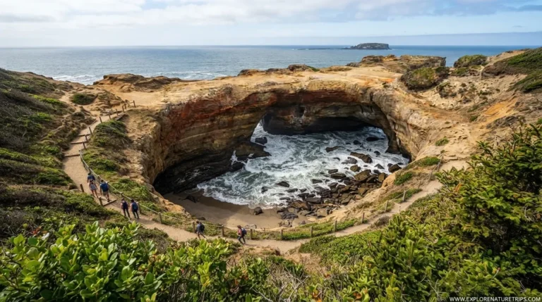
Natural Bridges is one of the most memorable coastal viewpoints along Oregon’s southern coast. Located within the Samuel H. Boardman State Scenic Corridor, the area combines dramatic sea arches, rugged cliffs, forested trails, and Pacific Ocean views.
But there is an important difference between seeing Natural Bridges from the viewpoint and attempting to descend toward the arches themselves. The viewpoint is short and easy to reach, while the unofficial descent is steep, loose, slippery, and potentially dangerous.
This guide brings together the practical details you need before visiting, including parking, driving distances, hiking directions, photography timing, seasons, and safety considerations.
Where Are Natural Bridges in Oregon?
Natural Bridges sits along US 101 within the Samuel H. Boardman State Scenic Corridor in southern Oregon.
The surrounding corridor includes several scenic stops, including:
- Arch Rock
- Whaleshead Beach
- Indian Sands
- China Beach
- Secret Beach
- Thunder Rock Cove
- Cape Ferrelo
- House Rock Viewpoint
The location is also close to Brookings and Gold Beach, making it possible to include Natural Bridges as part of a larger southern Oregon Coast road trip.
The Easy Way to See Natural Bridges
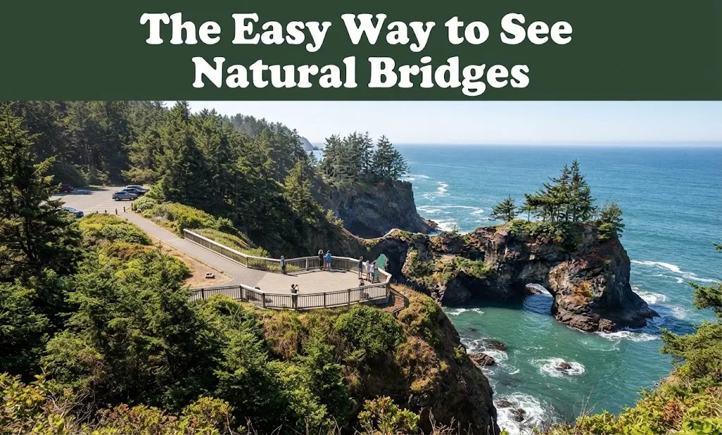
For most visitors, the simplest experience begins at the parking area beside Highway 101.
The main viewing area is only about 50 feet from the parking area according to the source descriptions. Another description gives the viewpoint walk as approximately 0.5 mile round trip.
This makes the viewpoint much more accessible than the steep route leading down toward the arches.
You do not need to descend into the rugged coastal terrain to appreciate the scenery. From the viewing area, you can see the dramatic coastline, ocean, cliffs, and natural formations without committing to the difficult unofficial route.
How to Find the Trailhead
The Natural Bridges parking area is directly off Highway 101.
Because the parking area is relatively small, arriving early can make the visit easier, particularly during the busy summer season.
Different firsthand descriptions estimate the parking capacity at approximately 5 cars, 7–10 cars, 8 cars, or 10–15 cars. The difference likely reflects the practical nature of the small parking area rather than a fixed large parking facility.
Step-by-Step Route Toward the Viewpoint
The easiest approach is straightforward:
- Drive along US 101 toward the Natural Bridges parking area.
- Park in the designated area.
- Walk toward the main viewing platform.
- Follow the short path to the overlook.
- Enjoy the views from the safe viewing area.
The overlook provides the simplest way to experience Natural Bridges without tackling the steep terrain below.
The More Difficult Route Toward the Arches
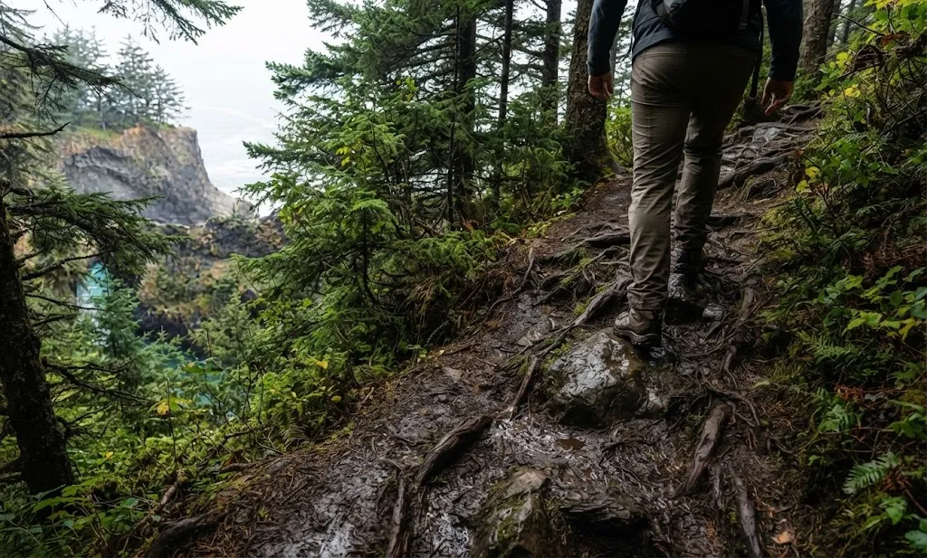
Several of the source descriptions provide directions for the unofficial route toward the Natural Bridges arches.
A commonly described sequence begins at the right side of the parking area:
- Start from the right corner of the parking lot.
- Follow the small path through the trees.
- Take the left at the first fork.
- Take the left again at the next fork.
- Continue until the route becomes steep.
- Descend toward the cove.
- Continue through increasingly rocky and uneven terrain toward the arches.
- Return using the same general route.
Another description gives a similar route but notes a Y-shaped path, where the left side provides a view toward the cove while the right side heads toward the top of the arch.
Why the Arch-Level Route Requires Caution
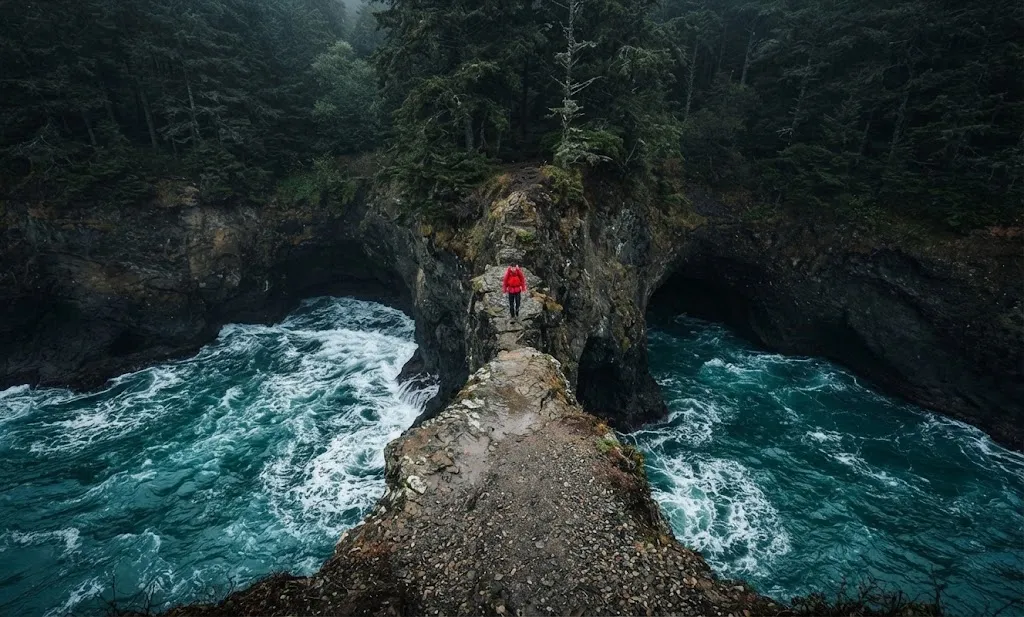
The difficult route is very different from the easy viewpoint.
Descriptions of the descent mention:
- Very steep slopes
- Loose dirt
- Slippery ground
- Mud
- Roots
- Rocky sections
- Unmarked or poorly defined sections
- Steep drop-offs
- Exposure to heights
One firsthand account describes slipping even during a dry, hot Labor Day morning at around 6 a.m.
The route should therefore not be treated like an ordinary short coastal walk simply because the distance is relatively short.
The main viewing area provides the safer way to experience the scenery.
A Better Choice for a Simple Visit
If your priority is scenery rather than a challenging descent, stay at the main viewpoint.
The nearby official or easier options described in the source material include:
- A southern route of about 1 mile round trip
- A northern route toward Thunder Rock Cove of about 1 mile round trip
- The short Natural Bridges viewpoint walk
This gives visitors several ways to enjoy the area without automatically committing to the steep arch-level descent.
How Long Does the Visit Take?
The time depends on what you want to do.
For a simple viewpoint stop, you can expect a relatively short visit. For example, another stop in the same corridor, Arch Rock, is described as taking approximately 20 minutes.
A more extensive visit to Natural Bridges will take longer if you spend time photographing the coastline, exploring nearby viewpoints, or attempting the difficult terrain.
Rather than rushing, allow enough time to enjoy the scenery and assess trail conditions before continuing.
Best Time to Visit Natural Bridges
The area can be visited year-round, but the experience changes with the seasons.
| Season | Months | What the source material highlights |
|---|---|---|
| Spring | March–May | Changing coastal conditions |
| Summer | June–August | Popular period; early arrival recommended |
| Fall | September–November | Cooler seasonal conditions |
| Winter | December–February | Rain and storm-watching opportunities |
For summer visits, arriving before 9 a.m. can help you avoid some of the busiest conditions.
Some descriptions also note that February and the end of the year can feel quieter.
Sunrise or Sunset: Which Is Better for Photos?
Photography is one of the major attractions at Natural Bridges.
The source material highlights both sunrise and sunset, although different experiences favor different times.
Sunrise can provide softer early light, while sunset can create backlighting around the arches.
The hour before sunset is specifically highlighted as a useful photography period.
Another visitor went at around 6 a.m. and found that the light did not produce the dramatic beams seen in some photographs. The position of the winter sun may help create different lighting conditions.
What About Midday Photography?
Midday can still provide impressive scenery, but it may be less favorable for dramatic photographs.
One firsthand visit around high noon produced harsher and brighter light.
For photographers, this means timing can make a significant difference. If your main objective is atmospheric images, consider planning around:
- Sunrise
- Golden hour
- The hour before sunset
- Overcast conditions
What Should You Bring?
For a simple viewpoint visit, you do not need a large amount of equipment.
For anyone considering the more difficult terrain, the practical packing suggestions mentioned in the source material include:
- Sturdy hiking boots
- Water bottle
- Backpack
- Jacket
- Sunscreen
- Bug spray
- Headlamp
- Camera
- Polarizing filter
A headlamp can be particularly useful for an early sunrise or late sunset visit.
Natural Bridges Weather
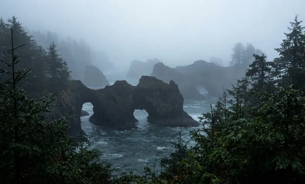
Coastal weather can change the experience considerably.
The source material describes summer temperatures around the 60s°F, while fog and chilly conditions can occur during summer.
Winter can bring substantial rain.
That matters because the difficult dirt descent becomes particularly problematic when wet. Loose soil and steep slopes can become slippery even when conditions appear manageable.
Driving to Natural Bridges From Brookings
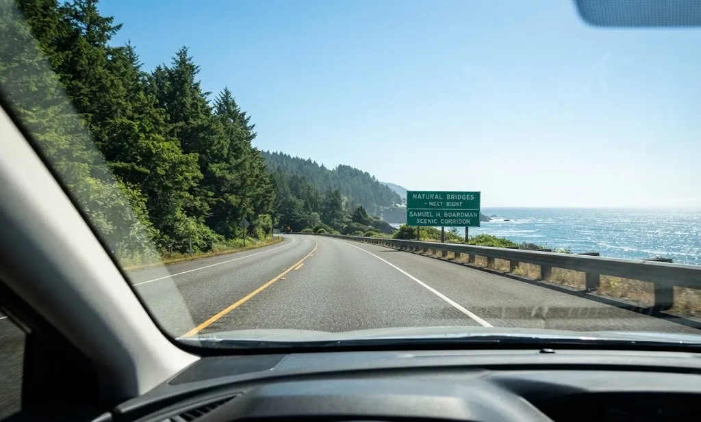
Brookings is one of the most useful nearby reference points.
One source gives the distance from Brookings as approximately 11.3 miles, with a driving time of around 14 minutes.
Another source places Brookings approximately 11 miles south of Natural Bridges.
The area is therefore easy to combine with other southern Oregon Coast stops.
Driving From Gold Beach
From Gold Beach, one route reference gives:
- Distance: 16.8 miles
- Driving time: approximately 19 minutes
This makes Natural Bridges accessible from either direction along Highway 101.
How Far Is Natural Bridges From Portland?
For travelers coming from Portland, the journey is considerably longer.
One source lists approximately:
- 380 miles
- Around 6.5 hours of driving
Because of this, Natural Bridges works particularly well as part of a broader Oregon Coast itinerary rather than simply as a short day trip from Portland.
Nearby Secret Beach
Secret Beach is another popular stop in the same coastal area.
The source material places it only about 2 minutes north of Natural Bridges in one description.
Other route details mention:
- About 1/4 mile of trail in one description
- About 1.6 miles in another route description
- A parking reference around 1/3 mile south of milepost 345
These figures come from different descriptions of access and should not be treated as one single measurement.
Arch Rock
Arch Rock is another nearby scenic stop.
The information gathered from the five pages describes:
- A large parking area
- A bathroom
- A short, relatively level path
- Approximately 20 minutes for a quick stop
It is located a few miles north of the Natural Bridges area.
Morning light can work well for photographs, while sunset may create backlighting.
Other Places Along the Corridor
If you are building a longer itinerary, the surrounding Samuel H. Boardman corridor includes numerous scenic locations.
Some of the named places include:
| Place | Highlight |
|---|---|
| Arch Rock | Coastal rock formation and short viewpoint |
| Whaleshead Beach | Beach and coastal scenery |
| Indian Sands | Coastal landscape |
| China Beach | Scenic coastal stop |
| Secret Beach | Secluded beach access |
| Thunder Rock Cove | Nearby hiking option |
| Cape Ferrelo | Approximately 1-mile hike mentioned |
| House Rock Viewpoint | Scenic coastal viewpoint |
The corridor itself is described in the source material as approximately 18 miles long.
Natural Bridges and the Oregon Coast Trail
The Natural Bridges area sits within a much larger coastal hiking landscape.
The source material references the Oregon Coast Trail as approximately 362 miles long and passing through 28 coastal towns.
Within the Samuel H. Boardman area, approximately 27 miles of the trail are discussed.
This puts Natural Bridges within a much broader network of coastal scenery rather than making it an isolated attraction.
How Natural Bridges Were Formed
The bridges are natural geological formations shaped over long periods.
The descriptions explain that cracks in coastal rock were gradually enlarged through the effects of wind, water, and waves.
Over time, these processes can create arches and sea caves.
The formations are not permanent structures. Continued coastal erosion means their appearance can change over long periods.
A Note About the Seven Bridges
One source describes the Natural Bridges area as containing 7 natural bridges, although not all of them are visible from the main viewpoint.
This is one reason the area can feel larger and more complex than the simple roadside overlook suggests.
Safety Checklist Before You Go
Before attempting any steep route, consider these basic points from the firsthand trail descriptions:
- Check whether the ground is wet or dry.
- Wear sturdy footwear.
- Be prepared for loose dirt.
- Take extra care around steep edges.
- Do not assume a short distance means an easy hike.
- Avoid the difficult descent if you are uncomfortable with heights.
- Do not continue simply because other visitors are doing it.
- Allow enough daylight for your return.
- A headlamp can help during sunrise or sunset visits.
- The main viewpoint remains the straightforward alternative.
The source material also describes search-and-rescue responses and serious accidents associated with the steep terrain. The safest choice for many visitors is therefore to enjoy Natural Bridges from the established viewing area.
A Simple Natural Bridges Visit Plan
For travelers who want an easy and practical experience, this basic plan follows the useful information from the five sources:
Step 1: Arrive via US 101.
Step 2: Park at the Natural Bridges area.
Step 3: Walk to the main viewpoint.
Step 4: Spend time photographing the arches and coastline.
Step 5: If conditions are suitable, visit nearby Arch Rock or Secret Beach.
Step 6: Consider other Samuel H. Boardman stops such as Whaleshead Beach or Indian Sands.
Step 7: If you are considering a difficult trail, evaluate the terrain carefully before proceeding.
FAQs
Is Natural Bridges Oregon easy to reach?
The main viewpoint is relatively easy to reach from the parking area. The viewing area is only about 50 feet from parking in the source descriptions, while another description gives the viewpoint walk as about 0.5 mile round trip.
How long is the Natural Bridges hike?
It depends on which route you mean. The easy viewpoint walk is about 0.5 mile round trip, while other nearby routes are around 1 mile round trip. The unofficial route toward the arches is a different, steep route and should not be judged by distance alone.
Is Natural Bridges open year-round?
The source material describes Natural Bridges as a year-round destination.
What is the best time to photograph Natural Bridges?
Sunrise, golden hour, and the hour before sunset are highlighted as useful photography periods. Weather and seasonal sun position can change the appearance of the arches.
Can I visit Natural Bridges in summer?
Yes. Summer is one of the busiest periods, and arriving before 9 a.m. is suggested in the gathered information.
How far is Natural Bridges from Brookings?
One route description gives approximately 11.3 miles and about 14 minutes from Brookings.
How far is Natural Bridges from Gold Beach?
One route description gives approximately 16.8 miles, requiring around 19 minutes of driving.
Is the route down to the arches safe?
The source descriptions characterize the descent as very steep, loose, slippery, and potentially dangerous. The main viewpoint provides an easier alternative.
How many natural bridges are there?
One of the source descriptions states that the area contains 7 natural bridges, although not all can be seen from the primary viewpoint.
What should I wear?
For the rougher terrain, sturdy hiking boots are recommended in the firsthand descriptions. Wet conditions can make loose slopes particularly slippery.
Can I combine Natural Bridges with other attractions?
Yes. Nearby places discussed in the source material include Arch Rock, Secret Beach, Whaleshead Beach, Indian Sands, China Beach, Thunder Rock Cove, Cape Ferrelo, and House Rock Viewpoint.
Final Takeaway
Natural Bridges offers two very different experiences. The first is a simple coastal viewpoint that requires only a short walk from the parking area. The second involves attempting the steep terrain toward the arches themselves.
For most visitors, the main viewpoint provides an excellent way to experience the dramatic scenery without taking unnecessary risks. If you want photographs, plan around sunrise or sunset, check the weather, arrive early during summer, and give yourself enough time to enjoy the surrounding Samuel H. Boardman coastline.
With distances such as 11.3 miles from Brookings, 16.8 miles from Gold Beach, and approximately 380 miles from Portland, Natural Bridges is also easy to place into a larger southern Oregon Coast itinerary.

Hi, I’m Marcus! I love exploring the outdoors and discovering incredible places. Through ExploreNatureTrips blog, I share my travel experiences, useful tips, and recommendations for the best sights, trails, and destinations to visit.