
9 of the Best Scenic Drives in Utah State for a Road Trip
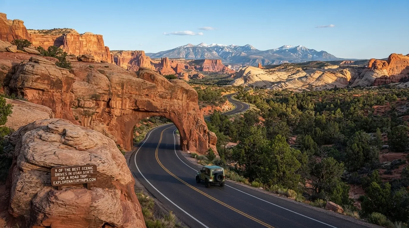
Utah is unusually rewarding for road trips because its scenery can change dramatically within a single drive. A route can move from red-rock canyons to alpine forests, high plateaus, mountain passes, lakes, and desert landscapes.
The four travel guides reviewed for this article highlight different aspects of Utah’s road network. Together, they point to several routes that stand out for scenery, accessibility, distance, elevation, and the variety of landscapes along the way.
If you’re choosing a drive, don’t look only at the scenery. Mileage, elevation, road surface, vehicle requirements, weather, and available time can make one route much better suited to your trip than another.
1. Highway 12
If you want one route that combines several types of Utah scenery, Highway 12 is the strongest all-around choice from the sources reviewed.
Outdoor Taste & Tour describes the full Panguitch-to-Torrey route as 124 miles, while Ridrs focuses on a 90-mile Torrey-to-Escalante section. The road connects major landscapes around Bryce Canyon National Park, Grand Staircase-Escalante, Boulder, and Capitol Reef National Park.
Key sections
- Panguitch to Bryce Canyon: 13 miles
- Bryce Canyon to Escalante: 50 miles
- Escalante to Boulder: 25 miles
- Boulder to Torrey: 36 miles
- Aquarius Plateau: approximately 11,000 feet
- The Hogback: approximately 1,000-foot drops on both sides
The Hogback is one of the most dramatic portions because the road follows a narrow ridge with major drops on both sides. The route then moves through the Escalante area and toward higher alpine country before descending toward Capitol Reef.
Good for: Travelers who want a long, scenery-focused road trip rather than a short drive.
2. Zion-Mount Carmel Highway
For a shorter but visually dramatic experience, the Zion-Mount Carmel Highway is an important choice.
The route is part of State Route 9 through Zion National Park. It climbs from the canyon floor through switchbacks before reaching the famous tunnel and continuing into the park’s eastern landscape.
The number to remember
The Zion-Mount Carmel Tunnel is 1.1 miles long and was completed in 1930. Large vehicles, including RVs, buses, and wide trucks, require a special permit and escort through the tunnel according to Outdoor Taste & Tour.
The Nature Seeker also describes the Zion scenic-drive area as approximately 30 miles total, while Ridrs describes its broader SR-9 section as 58 miles from the I-15 interchange to US-89 at Mount Carmel. These are different route measurements, so travelers should consider the exact section they intend to drive.
Good for: A dramatic Zion experience without committing to a very long road trip.
3. Mirror Lake Scenic Byway
The Mirror Lake Scenic Byway is the standout choice when mountains, forests and alpine lakes are more appealing than desert scenery.
Only In Your State describes the route as 42 miles, beginning in Kamas and continuing toward the Wyoming border through the High Uinta Mountains. Bald Mountain Pass reaches 10,687 feet.
Outdoor Taste & Tour gives slightly different elevation figures for the route:
- Kamas: 6,500 feet
- Bald Mountain Pass: 10,715 feet
- Mirror Lake: 10,000 feet
That means the drive involves a substantial elevation change, with alpine meadows, forests and lakes along the way.
Why choose this drive?
It’s particularly useful if your idea of a scenic drive includes:
- Mountain scenery
- Alpine lakes
- Forest landscapes
- Fishing stops
- High-elevation viewpoints
- A substantial change in elevation
Good for: Travelers who prefer alpine scenery over desert landscapes.
4. Nebo Loop Scenic Byway
The Nebo Loop Scenic Byway offers a shorter alternative to Utah’s huge road-trip routes.
Only In Your State lists the loop at 38 miles and estimates about 1.5 hours to drive straight through. However, it recommends allowing an entire day if you want to stop and explore along the way.
The Nature Seeker gives the route as roughly 40–50 miles, again illustrating why mileage can vary depending on how the route is measured.
The drive is south of Salt Lake City and provides a mixture of desert, greenery and mountain scenery.
Best approach
Don’t treat the 1.5-hour figure as the total amount of time you’ll need for a relaxed visit. That’s the approximate straight-through driving time cited by Only In Your State. If you plan to stop for scenery and exploration, reserve considerably more time.
Good for: A flexible day trip with a manageable driving distance.
5. Logan Canyon Scenic Byway
The Logan Canyon Scenic Byway is one of the strongest northern Utah choices in the data.
Only In Your State lists the route at 41 miles, running along US-89 from Logan toward Garden City and ending near Bear Lake.
Ridrs describes a longer 54-mile Logan Canyon section from Cache Valley to Bear Lake Summit, with the summit reaching 7,800 feet.
The difference is useful rather than confusing: it shows that the reported distance depends on which endpoints are being counted.
What makes it useful?
The route combines:
- Canyon scenery
- Mountain roads
- Higher elevations
- Curving road sections
- Access toward Bear Lake
Good for: Travelers starting in northern Utah who want a mountain-focused drive.
6. Little Cottonwood Canyon Scenic Byway
For a relatively short drive with significant elevation, look at State Route 210 through Little Cottonwood Canyon.
Only In Your State highlights the route toward Snowbird and Alta, along with hiking, recreation, dining and overnight opportunities.
Ridrs provides more specific driving figures:
- Approximately 9 miles in its featured-route measurement
- About 15 minutes for the rated one-way section
- Nearly 9,000 feet of elevation
- Approximately 13 miles from the valley floor in its broader route description
- 64 avalanche paths along SR-210
The Ridrs rating classifies the featured route as Demanding, emphasizing its gradient and exposure rather than its overall length.
Good for: Drivers who want mountain scenery close to the Salt Lake City area.
7. Dinosaur Diamond Prehistoric Highway
If distance itself is part of the adventure, the Dinosaur Diamond Prehistoric Highway stands apart from the shorter scenic drives.
Only In Your State lists it at 512 miles, making it by far the longest route in its nine-drive roundup. The route forms a diamond-shaped journey through eastern Utah and briefly into Colorado, with Dinosaur National Monument as a major highlight.
This is not the same type of outing as a 20-mile or 40-mile scenic drive. It makes more sense as a long road-trip route where the journey itself is part of the experience.
Good for: Travelers planning an extended road trip rather than a few-hour drive.
8. Brian Head-Panguitch Lake Scenic Byway
The Brian Head-Panguitch Lake Scenic Byway, also known as State Route 143, covers 51 miles between Panguitch and Parowan.
The route passes:
- Brian Head Resort
- Panguitch Lake
- Cedar Breaks National Monument
Only In Your State also points travelers toward the Cedar Breaks Scenic Byway as an additional way to extend the experience.
This route is particularly interesting because it combines mountain scenery, recreation areas and a national monument within a relatively compact 51-mile drive.
Good for: Travelers looking for a mountain route with several recognizable stops.
9. Beaver Canyon Scenic Byway
The Beaver Canyon Scenic Byway on UT-153 is one of the more demanding mountain options in the Ridrs data.
The route covers 19 miles from Beaver into Fishlake National Forest and reaches approximately 9,200 feet. Sustained grades are listed at 9–10%.
Ridrs places this route among Utah’s more rider-focused mountain roads because of its combination of curves, elevation and relatively light traffic.
For high-elevation routes such as this one, timing matters. Ridrs says UT-153 typically opens by late May but can close again in October.
Good for: Experienced drivers and riders who specifically want mountain elevation and curves.
Other Scenic Drives Worth Knowing
The nine routes above cover the strongest combined themes from the four sources, but several additional drives from the deserve a quick mention.
Arches National Park Scenic Drive
The Nature Seeker lists the main Arches road at 20 miles, with approximately 1 hour needed to drive one end. It states that an all-wheel-drive vehicle is not required for this drive.
Island in the Sky Road
The main scenic road through the Island in the Sky area of Canyonlands National Park is listed at 10 miles. The Nature Seeker also notes that the road provides access to several hikes from the high part of the park.
Dead Horse State Park Road 313
This route is approximately 10 miles and does not require AWD according to The Nature Seeker. The road leads into Dead Horse State Park near Canyonlands country.
White Rim Trail
The White Rim Trail is approximately 100 miles and AWD is recommended in The Nature Seeker’s guide. It is primarily a dirt and rugged route through Canyonlands and can also be traveled by bicycle.
Valley of the Gods
Near Mexican Hat, Valley of the Gods provides a shorter 17-mile scenic drive that takes roughly 30 minutes without extended stops. AWD is recommended by The Nature Seeker.
Road 89
The Nature Seeker describes the Kanab-to-Page section of Road 89 as approximately 100 miles, with views and access around Kanab, Kaibab National Forest, Vermilion Cliffs and the Grand Staircase-Escalante area.
Potash Road
For something much shorter, Potash Road near Moab is listed at just 5 miles and does not require AWD according to The Nature Seeker.
How to Choose the Right Utah Scenic Drive
The best route depends on what you actually want from the day.
| If you want… | Consider… |
|---|---|
| A long, varied road trip | Highway 12 |
| Dramatic Zion scenery | Zion-Mount Carmel Highway |
| Alpine lakes and mountains | Mirror Lake Scenic Byway |
| A manageable day trip | Nebo Loop |
| Northern Utah canyon scenery | Logan Canyon |
| A short mountain drive | Little Cottonwood Canyon |
| A very long road trip | Dinosaur Diamond |
| Mountain recreation | Brian Head-Panguitch Lake |
| Higher-elevation curves | Beaver Canyon |
This approach is more useful than simply ranking the roads from “best” to “worst.” A 512-mile route serves a very different traveler than a 5-mile Moab drive.
How Long Should You Spend?
Your available time should influence your choice.
For 1–2 hours
Look at shorter options such as:
- Nebo Loop: about 1.5 hours straight through
- Arches: about 1 hour
- Valley of the Gods: about 30 minutes without lengthy stops
- Potash Road: 5 miles
- Little Cottonwood Canyon: approximately 15 minutes for the Ridrs-rated one-way section
These times are driving estimates or route measurements from , not recommended total visit times. Stops, photography, hiking and traffic can extend the day.
For a full day
Nebo Loop, Mirror Lake, Highway 12, and the Brian Head-Panguitch Lake route offer more opportunities to stop and explore.
Only In Your State specifically recommends allowing an entire day for Nebo Loop if you want to explore instead of driving straight through.
For a longer road trip
Highway 12 and the 512-mile Dinosaur Diamond Prehistoric Highway are better suited to travelers who want the driving itself to be a major part of the trip.
When Is the Best Time to Drive?
Season is one of the most important practical considerations.
Outdoor Taste & Tour identifies April–May and September–October as strong periods for Utah scenic drives, while noting that summer can be very hot at lower elevations.
Ridrs gives a more detailed seasonal picture:
- April–early June: useful shoulder-season period
- September–October: another strong shoulder season
- Late May–June: more reliable for some high-elevation roads
- July–August: early starts are recommended for southern Utah because canyon temperatures can exceed 100°F
- August: wildfire smoke can reduce visibility
- Some northern canyon roads can retain snow into May
- UT-153 typically opens by late May and can close again in October
Conditions can vary by elevation, so a comfortable season in southern Utah does not automatically mean every high mountain road will be open.
Do You Need an AWD or 4WD Vehicle?
Not necessarily.
Several major scenic drives can be handled without AWD. The Nature Seeker specifically marks Arches, Dead Horse, Island in the Sky, Road 12, Road 63, Zion, Interstate 15, Factory Butte, Nebo Loop, Big Cottonwood Canyon, Road 89, and Potash Road as not requiring AWD in its route descriptions.
However, conditions change on more rugged routes.
Hole in the Rock Road is marked as requiring AWD, while the White Rim Trail, Valley of the Gods, Burr Trail, Cottonwood Canyon Road, and Onion Creek Trail have AWD listed as recommended.
Outdoor Taste & Tour similarly notes that a standard passenger car can handle most scenic drives, but some roads in Grand Staircase-Escalante and the San Rafael Swell require a high-clearance 4WD vehicle.
Fuel and Road-Planning Tips
One simple planning detail can make a major difference: fuel availability.
Outdoor Taste & Tour warns that gas stations are sparse in rural Utah and recommends filling up whenever the opportunity is available.
For longer or remote drives:
- Check the route distance before leaving.
- Know whether the road is paved, gravel or rugged.
- Don’t assume every scenic road has frequent fuel stops.
- Allow extra time for viewpoints and unexpected stops.
- Check road conditions before high-elevation travel.
- Treat vehicle requirements as part of route selection, not an afterthought.
The Nature Seeker also warns that some of its listed scenic drives are very remote.
Utah Scenic Drives at a Glance
Utah’s road network is much broader than a handful of national-park roads. Ridrs lists 34 routes covering 800 total miles, with elevations ranging from 2,621 to 10,594 feet across its Utah route data. Its route character breakdown includes 5 Moderate, 19 Engaging, 9 Demanding, and 1 Technical routes.
That range explains why planning matters. A short route can still be demanding if it climbs rapidly or has difficult terrain, while a longer highway can be comparatively straightforward.
FAQs
What is the best scenic drive in Utah?
Highway 12 is the strongest all-around choice in the combined data because it links multiple landscapes and major destinations. Depending on the endpoints used, the route is described as 90 or 124 miles.
How long is Highway 12 in Utah?
Outdoor Taste & Tour describes Highway 12 from Panguitch to Torrey as 124 miles. Ridrs focuses on a 90-mile Torrey-to-Escalante section.
Which Utah scenic drive is best for mountains?
Mirror Lake Scenic Byway, Little Cottonwood Canyon, Logan Canyon, and Beaver Canyon Scenic Byway are strong mountain-focused choices based on the elevations and landscapes described by the sources.
How long is the Mirror Lake Scenic Byway?
Only In Your State lists it at 42 miles, from Kamas toward the Wyoming border. Bald Mountain Pass reaches 10,687 feet in that source.
How long does Nebo Loop take?
Only In Your State estimates approximately 1.5 hours to drive the 38-mile loop straight through, but recommends allowing an entire day if you want to explore along the route.
Do I need 4WD for Utah scenic drives?
Not for most major paved scenic drives. However, some rugged routes require or recommend AWD/high-clearance 4WD. Hole in the Rock Road, for example, is marked as requiring AWD by The Nature Seeker.
When is the best season for Utah scenic drives?
The sources consistently favor spring and fall, with Outdoor Taste & Tour specifically highlighting April–May and September–October. Ridrs gives April–early June and September–October as broad shoulder-season windows, while noting that high elevations can remain snowy into May.
Which Utah scenic drive is the longest in this list?
The Dinosaur Diamond Prehistoric Highway is listed at 512 miles by Only In Your State, making it the longest route in that nine-route roundup.
What should I check before a Utah scenic drive?
Check distance, elevation, vehicle requirements, fuel availability, seasonal road conditions, and weather before leaving. This is particularly important for remote and high-elevation roads. Outdoor Taste & Tour specifically notes sparse rural fuel stations, while Ridrs emphasizes seasonal road closures and conditions.
Final Thought
The best Utah scenic drive isn’t necessarily the longest or most famous one. Highway 12 is ideal for a broad road-trip experience, Zion-Mount Carmel Highway delivers dramatic canyon scenery, Mirror Lake focuses on alpine landscapes, and shorter routes such as Nebo Loop make it easier to build a day around driving and stops.
For rugged terrain, pay attention to vehicle requirements. For high elevations, pay attention to the season. And for remote routes, plan fuel and road conditions before setting out.
With distances ranging from just 5 miles on Potash Road to 512 miles on the Dinosaur Diamond Prehistoric Highway, Utah offers a scenic drive for almost every type of road-trip plan. The key is choosing the route that matches your time, vehicle, season, and preferred landscape.

Hi, I’m Marcus! I love exploring the outdoors and discovering incredible places. Through ExploreNatureTrips blog, I share my travel experiences, useful tips, and recommendations for the best sights, trails, and destinations to visit.
6 Comments