
North Cascades National Park Guide: Trails, Maps & Tips

North Cascades National Park in Washington State is an unforgettable destination for travelers who enjoy alpine lakes, glacier-carved valleys, forest trails, rugged mountain peaks, and scenic road trips. Known for its dramatic landscapes and remote wilderness, the park offers experiences ranging from short lakeside walks to challenging mountain hikes.
Planning your first visit requires more than choosing a trail. You also need to understand the park’s geography, driving routes, seasonal road closures, campground locations, and the time required to reach different destinations. Cell service can be unreliable, and mountain weather may change quickly.
This guide brings those details together to help you plan a realistic visit, whether you have one day, a weekend, or several days to explore.
North Cascades National Park at a Glance
North Cascades National Park became a national park in 1968. It forms part of a larger protected landscape that includes Ross Lake National Recreation Area and Lake Chelan National Recreation Area.
The surrounding region contains mountain forests, alpine lakes, glacier-fed waterways, and extensive hiking opportunities. However, the entire region is not accessible directly by car, and some popular trails are located in neighboring national forests rather than inside the national park’s formal boundaries.
| Trip detail | What to know |
|---|---|
| Location | Washington State, United States |
| Established as a national park | 1968 |
| Main scenic road | North Cascades Highway, State Route 20 |
| Typical first visit | 1–3 days |
| Best-known lake viewpoint | Diablo Lake Overlook |
| Popular short hike | Rainy Lake Trail |
| Popular mountain hike | Maple Pass Loop |
| Major eastern viewpoint | Washington Pass Overlook |
| Remote destination | Stehekin |
| Main planning concern | Seasonal road access and mountain weather |
| Entrance fee | No standard entrance fee for North Cascades National Park itself; other services or recreation areas may have separate charges |
Photos



Understanding the North Cascades Region
One of the most useful first steps is understanding that the North Cascades experience covers several connected but distinct areas.
North Cascades National Park

The national park protects rugged mountain wilderness, glaciers, forests, and remote hiking destinations. Many areas have no direct road access, so reaching them may require a substantial hike or a backcountry trip.
Not every famous North Cascades trail is inside the park boundary. Always check the trail’s precise location before planning permits, transportation, or overnight stays.
Ross Lake National Recreation Area

This area includes several of the region’s best-known roadside attractions, including Diablo Lake Overlook, Ross Lake viewpoints, and recreation opportunities around the lakes.
It is particularly useful for first-time visitors because it combines scenic driving with accessible stops and nearby trails.
Lake Chelan National Recreation Area

The remote community of Stehekin lies within this recreation area. It is not connected to the normal road network, making transportation planning especially important.
Visitors typically reach Stehekin by passenger boat from Chelan, floatplane, or hiking routes.
How to Reach North Cascades National Park
For many visitors, Seattle is the most practical starting point. A rental car provides flexibility because scenic overlooks, trailheads, campgrounds, and small communities are spread across a large area.
Driving from Seattle

Approximate driving times depend on traffic, the chosen destination, and whether State Route 20 is open.
| Destination | Approximate driving time from Seattle |
|---|---|
| Marblemount | 2–2.5 hours |
| Diablo Lake Overlook | 3–3.5 hours |
| Mazama or Winthrop | 3.5–4 hours when the highway is open |
| Eastern-side destinations during a major detour | Potentially 4–6 hours or longer |
These are planning estimates, not guaranteed travel times. Roadwork, weather, traffic, and seasonal closures may add substantial delays.
The western approach

The western route generally follows I-5 toward Burlington or Sedro-Woolley before continuing east on State Route 20.
Marblemount is a useful stop for fuel, food, and trip preparation. Farther along, Newhalem offers visitor information and access to short walks.
This route is a practical choice for visitors concentrating on Diablo Lake, Gorge Creek Falls, and nearby scenic stops.
The eastern approach
The eastern side is associated with Rainy Pass, Washington Pass, Mazama, and Winthrop. It provides access to alpine hiking, mountain viewpoints, and communities where travelers can find accommodation.
If your primary goal is Maple Pass Loop or Washington Pass Overlook, plan your overnight stay and driving route around the eastern side rather than assuming every attraction can be reached quickly from Seattle.
Is it possible to drive across the park?
State Route 20 crosses the North Cascades region, but the highway closes seasonally along its mountainous section because of snow and avalanche hazards. During a closure, you cannot drive directly between the western and eastern approaches using that section of highway.
Closures and reopening dates vary from year to year. Check the Washington State Department of Transportation’s current road-status information before finalizing your itinerary.
Best Scenic Stops Along North Cascades Highway
You do not need to complete a difficult hike to enjoy the scenery. Several roadside stops provide impressive views with relatively little walking.
1. Diablo Lake Overlook
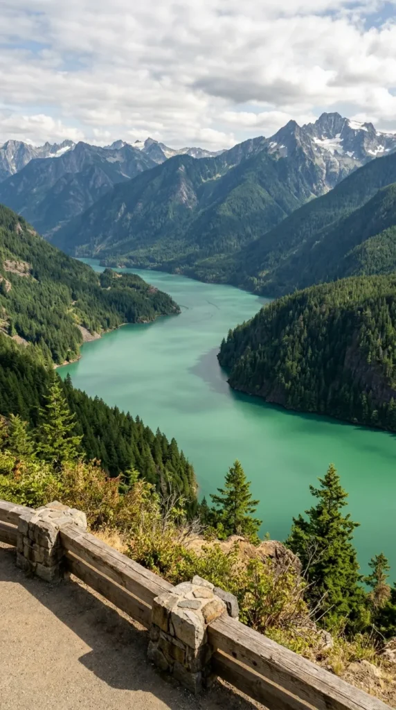
Diablo Lake is one of the region’s signature landscapes. Its striking turquoise appearance comes from fine rock particles suspended in the water, which scatter sunlight.
The overlook is a strong choice for first-time visitors because it provides expansive views without requiring a long hike.
Best for: Photography, scenic breaks, families, and travelers with limited time.
2. Ross Lake Overlook
Ross Lake Overlook provides another opportunity to appreciate the scale of the surrounding mountains and water. It works well as part of a longer drive along State Route 20.
Check the weather before expecting distant mountain views, as low clouds can obscure the landscape.
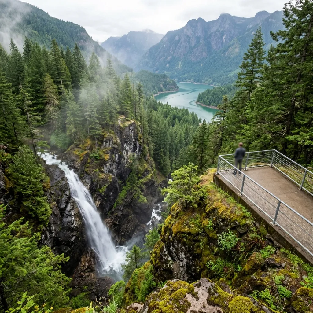
3. Gorge Creek Falls and Gorge Lake Overlook
This area offers a combination of waterfall scenery, dramatic rock formations, and views of the surrounding gorge. It is a useful stop for visitors who want to break up the drive with a short walk.
Use designated parking areas and marked paths rather than stopping on unsafe road shoulders.
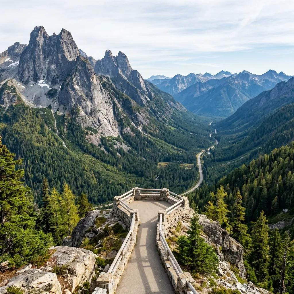
4. Washington Pass Overlook
Washington Pass Overlook offers dramatic views of Liberty Bell Mountain, Early Winters Spires, and neighboring peaks.
The short viewpoint walk makes it attractive to visitors who want mountain scenery without committing to a long trail. However, reaching the overlook depends on the seasonal accessibility of State Route 20.
5. Newhalem and Trail of the Cedars
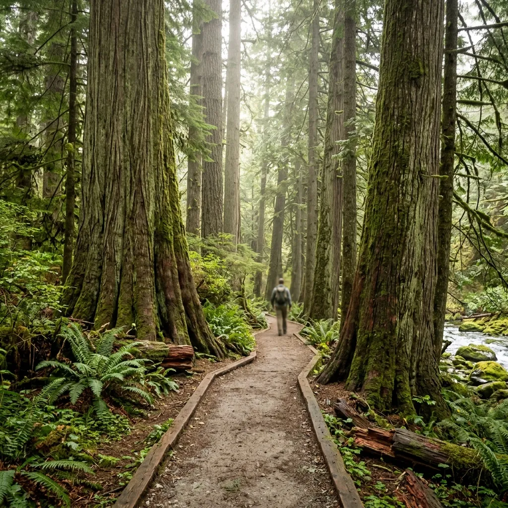
Newhalem is a convenient place to learn about the area’s history and obtain visitor information when facilities are open. The nearby Trail of the Cedars provides a forest setting and a suspension bridge over the Skagit River.
It is a good addition to a relaxed itinerary that includes several short stops instead of one demanding hike.
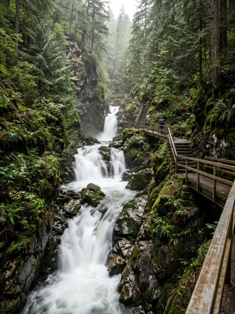
6. Ladder Creek Falls
Ladder Creek Falls is another short outing near Newhalem. Steps and uneven surfaces may affect accessibility, so check local conditions before visiting if you have mobility concerns.
7. Rainy Pass
Rainy Pass is a key access point for hikes such as Rainy Lake and Maple Pass Loop. It is especially appealing during the autumn larch season, although parking and trail conditions can change significantly with weather and visitor numbers.
Best Hikes for First-Time Visitors
Choose a hike based on your available time, fitness, weather, and experience with mountain trails. Distance alone does not determine difficulty: elevation gain, trail surface, snow, and exposure can make a shorter route more demanding than expected.
The following distances are approximate planning figures. Trail descriptions and published measurements can differ, so confirm the current official trail information before setting out.
| Trail | Approximate distance | Elevation gain | General difficulty |
|---|---|---|---|
| Sterling Munro Boardwalk | 330 feet | Minimal | Easy |
| Trail of the Cedars | About 0.3–1.9 miles, depending on the route description | Minimal | Easy |
| Rainy Lake Trail | About 1–2 miles round trip | Low | Easy |
| Thunder Knob | 3.6 miles round trip | About 500–635 feet | Moderate |
| Blue Lake Trail | About 4.4–4.6 miles round trip | About 1,000 feet | Moderate |
| Cutthroat Lake | About 4 miles round trip | About 400 feet | Easy to moderate |
| Maple Pass Loop | About 7–7.5 miles | About 2,000–2,150 feet | Strenuous |
| Cascade Pass Trail | About 7.4 miles round trip | About 1,800 feet | Strenuous |
| Thornton Lakes Trail | About 10.6 miles round trip | About 2,500 feet | Strenuous |
| Cascade Pass plus Sahale Arm | About 12 miles round trip | About 4,000 feet | Very strenuous |
Trail-distance note: Published measurements differ between route descriptions, trail variations, and turnaround points. Use one current, authoritative trail description for the exact route you intend to hike.
Easy hikes
Rainy Lake Trail
Rainy Lake is a good option for visitors who want an alpine lake without committing to a major climb. The trail is generally gentle compared with the region’s more demanding mountain routes.
Allow time for photographs and breaks rather than treating the distance as a strict schedule. Check for snow, fallen trees, or temporary restrictions early in the season.
Sterling Munro Boardwalk
This short boardwalk is a practical option for a quick stop near the visitor-center area. It allows travelers to enjoy mountain views without undertaking a lengthy hike.
It can fit easily into a half-day sightseeing route, especially when combined with other nearby stops.
Trail of the Cedars
This walk combines forest scenery with a suspension bridge. It is useful for families and travelers who want a relatively short outing.
Confirm the current trail layout before relying on a specific distance, because descriptions may include different nearby walking routes.
Moderate hikes
Thunder Knob
Thunder Knob provides an elevated perspective over Diablo Lake and the surrounding landscape. With approximately 3.6 miles of walking and several hundred feet of climbing, it is a reasonable choice for visitors who want more exercise than a roadside viewpoint offers.
Carry water and wear shoes suitable for dirt, roots, and uneven surfaces.
Blue Lake Trail
Blue Lake is popular for its mountain scenery, forested approach, and alpine setting. The roughly 4.5-mile round trip includes about 1,000 feet of elevation gain.
The climb is manageable for many prepared hikers, but it can feel strenuous for people unfamiliar with sustained uphill walking. Give yourself enough time to return before dark.
Challenging hikes
Maple Pass Loop
Maple Pass Loop is known for expansive views, alpine terrain, and golden larches in autumn. At approximately 7–7.5 miles with around 2,000 feet or more of elevation gain, it requires more preparation than a short lakeside walk.
Plan for a longer outing, carry extra layers, and check the forecast before departing. Snow and ice can make the route substantially more difficult outside the main hiking season.
Cascade Pass and Sahale Arm
Cascade Pass offers impressive mountain scenery, while continuing toward Sahale Arm adds a significant amount of climbing and exposure.
The combined route may reach approximately 12 miles round trip and 4,000 feet of elevation gain. It is best suited to experienced hikers who are prepared for demanding terrain, changing weather, and a long day outdoors.
Do not attempt the extended route simply because the initial trail seems manageable. Assess your energy and conditions before deciding whether to continue.
How to Plan Your Visit by Available Time
A good itinerary groups nearby attractions together and avoids unnecessary driving. Trying to combine every major viewpoint and long hike into a single day often creates a rushed and tiring experience.
One-day itinerary
This plan is ideal for a first visit focused on scenic driving and short walks.
Morning
- Leave Seattle early and travel toward Marblemount.
- Stop for fuel, food, and any last-minute supplies.
- Continue along State Route 20 toward Newhalem.
- Visit Trail of the Cedars if time and conditions permit.
Midday
- Stop at Gorge Creek Falls and nearby viewpoints.
- Continue to Diablo Lake Overlook.
- Eat a packed lunch at a suitable designated area.
Afternoon
- Visit a Ross Lake viewpoint.
- Continue toward Rainy Pass only if the road is open and your schedule allows.
- Return with enough daylight for the drive.
A full one-day road trip is best kept flexible. Choose a few priorities instead of trying to fit several long hikes into the same schedule.
Two-day itinerary
A weekend provides more time for hiking and less pressure to rush between stops.
| Day | Morning | Afternoon |
|---|---|---|
| Day 1 | Drive from Seattle; visit Newhalem and Trail of the Cedars | Explore Gorge Creek Falls, Diablo Lake Overlook, and Ross Lake viewpoints |
| Day 2 | Hike Rainy Lake or Blue Lake, depending on location and conditions | Visit Washington Pass Overlook if accessible, then travel toward your overnight base or return home |
For a more demanding second day, consider Maple Pass Loop instead of combining multiple shorter hikes. Stay overnight near the side of the region you plan to explore.
Three-day itinerary
A three-day visit allows a better balance of driving, hiking, and rest.
Day 1: Western scenic route
Explore Newhalem, Trail of the Cedars, Gorge Creek Falls, and Diablo Lake Overlook. Stay at a suitable campground or accommodation with confirmed availability.
Day 2: Choose one major hike
Select Blue Lake, Maple Pass Loop, or Cascade Pass according to your preferred difficulty and the access conditions. Avoid stacking several strenuous hikes into the same day.
Day 3: Eastern viewpoints or a relaxed return
If State Route 20 is open, explore Washington Pass Overlook and the surrounding eastern region. Otherwise, adjust your plan to remain on the accessible side of the highway.
Stehekin is better treated as a separate trip requiring dedicated transportation and time rather than an automatic addition to a short road trip.
Best Time to Visit North Cascades National Park
The best season depends on your preferred activities and tolerance for changing weather. Summer generally provides the broadest opportunities for hiking and scenic driving, while autumn is particularly attractive for larches and photography.
Summer: Hiking and scenic drives
Summer is usually the most practical period for a first visit. Many popular trails and mountain viewpoints are more accessible, although snow can remain at higher elevations.
Recommended activities include:
- Hiking Blue Lake or Rainy Lake.
- Visiting Diablo Lake Overlook.
- Exploring Washington Pass when accessible.
- Camping and photographing mountain landscapes.
- Planning longer hikes after checking weather and trail reports.
Expect more visitors at popular trailheads. Start early and have a backup plan if parking areas are full.
Autumn: Golden larches
Late September through October can provide beautiful fall scenery, with golden larches often becoming a major attraction in early to mid-October.
Timing varies with elevation and yearly weather patterns. Higher routes may experience snow or ice before lower-elevation trails.
Carry warm clothing, check daylight hours, and do not assume that every trail remains safe simply because the calendar says autumn.
Spring: Waterfalls and changing conditions
Spring can offer flowing waterfalls, green forests, and quieter lower-elevation trails. However, high-elevation hiking may still be limited by snow.
Some roads and trailheads may remain inaccessible, so a spring visit should focus on confirmed open areas rather than a fixed list of destinations.
Winter: Road access and lower-elevation activities
Winter conditions significantly limit access to parts of the North Cascades. State Route 20’s seasonal closure can prevent a direct drive across the mountains.
Before traveling, verify road conditions and select activities that are appropriate for the current snow, avalanche, and weather conditions. Do not rely on summer driving estimates or trail descriptions during winter.
Camping and Accommodation
Staying overnight near your chosen hiking area can save several hours of driving and make an early trail start easier.
Popular campground options
| Campground | General location or advantage | Planning consideration |
|---|---|---|
| Goodell Creek Campground | Near the western access corridor | Check seasonal operation and reservation rules |
| Newhalem Creek Campground | Near Newhalem and visitor facilities | Confirm available facilities and dates |
| Colonial Creek Campground | Convenient for Diablo Lake and nearby trails | Check reservations, site availability, and current restrictions |
| Gorge Lake Campground | Useful for travelers exploring the highway corridor | Verify access and current operating status |
| Mineral Park West Campground | In the surrounding national forest | Do not assume running water is available |
| Lone Fir Campground | Eastern-side option | Check current conditions and seasonal operation |
| Klipchuck Campground | Eastern-side option | Verify site availability and facilities |
Campground opening dates, water availability, toilets, fees, and reservation requirements can change. Confirm details with the relevant land-management agency before departure.
What to bring for camping
- A suitable tent and sleeping system for expected nighttime temperatures.
- Food stored according to local bear-safety rules.
- Drinking water or an appropriate treatment method.
- A headlamp and spare batteries.
- Warm layers and waterproof clothing.
- A map and offline navigation.
- A first-aid kit and emergency supplies.
Never leave food or scented items unsecured. Follow the current instructions provided at your campsite.
Alternative accommodation
Visitors who prefer a hotel or cabin can consider communities such as Marblemount, Winthrop, Mazama, or other nearby towns. The best base depends on which side of the region you intend to visit.
Stehekin is a special case because it does not have normal road access. Confirm boat or flight arrangements, accommodation, and return transportation before committing to an itinerary.
Essential Safety and Preparation Tips
Mountain conditions can change quickly. A trail that feels easy in good weather may become difficult when temperatures fall, visibility decreases, or snow covers the route.
Check conditions before leaving
Review:
- Official park alerts and trail reports.
- Current road status for State Route 20.
- Weather forecasts for the specific elevation you plan to visit.
- Campground availability and operating dates.
- Permit requirements for overnight backcountry trips.
- Any seasonal restrictions or closures.
A forecast for a nearby town may not accurately reflect conditions at a high mountain pass.
Carry the hiking essentials
For a day hike, prepare the traditional 10 hiking essentials:
- Navigation, including an offline map.
- Sun protection.
- Insulating clothing.
- A headlamp or flashlight.
- A first-aid kit.
- Fire-starting supplies where appropriate and permitted.
- Repair tools and emergency supplies.
- Extra food.
- Extra water and a suitable treatment method.
- Emergency shelter.
Adjust your supplies for the trail, weather, group size, and time of year. Carrying a phone alone is not a substitute for navigation because reception may be absent.
Respect wildlife and natural areas
Black bears and other wildlife inhabit the region. Maintain a safe distance, never feed animals, and follow current food-storage guidance.
Stay on established trails, pack out all trash, and avoid disturbing fragile alpine vegetation. These habits help protect the environment and reduce risks for other visitors.
Understand permit requirements
A scenic drive or ordinary day hike does not automatically require the same permits as an overnight backcountry trip. Requirements depend on the activity, location, and managing agency.
Before backpacking, camping outside established campgrounds, or visiting restricted areas, check the official rules for the exact destination.
Practical Budget and Trip Planning
A realistic budget should account for transportation, lodging, food, equipment, and any activity-specific charges. A park visit without a standard entrance fee can still involve campground fees, accommodation expenses, parking or recreation charges in other managed areas, and rental-car costs.
| Expense | How to plan |
|---|---|
| Transportation | Estimate fuel, rental car, and any detour mileage |
| Accommodation | Compare campgrounds, hotels, and cabins near your selected area |
| Food | Bring suitable snacks and meals for remote stretches |
| Hiking equipment | Check footwear, layers, maps, and emergency supplies before departure |
| Camping | Confirm site fees, reservations, and included facilities |
| Permits | Check whether your specific activity requires one |
| Backup funds | Allow for unexpected accommodation or route changes |
Do not rely on an old fee table for current prices. Check official booking and agency information close to your travel dates.
FAQ
How many days do you need for North Cascades National Park?
One day can cover a scenic drive and several viewpoints. Two to three days provide more time for hiking, camping, and exploring both sides of the region. Remote destinations such as Stehekin may require additional planning.
What is the best hike for first-time visitors?
Rainy Lake is a good option for a relatively gentle outing, while Thunder Knob provides a longer walk with lake views. Blue Lake is a stronger choice for visitors comfortable with several miles of hiking and sustained uphill climbing.
How long is the Blue Lake Trail?
The commonly reported distance is approximately 4.4–4.6 miles round trip, with around 1,000 feet of elevation gain. Confirm the current route description before your visit.
How long is Maple Pass Loop?
Maple Pass Loop is commonly reported at approximately 7–7.5 miles, with about 2,000–2,150 feet of elevation gain. Conditions can make the hike more demanding, particularly when snow or ice is present.
Is North Cascades National Park free to visit?
There is no standard entrance fee for North Cascades National Park itself. However, camping, lodging, transportation, permits for certain activities, and recreation services may involve separate costs. Check current official information before traveling.
When does North Cascades Highway close?
The highway’s mountainous section typically closes during winter because of snow and avalanche danger. Closure and reopening dates vary each year, so consult current Washington State Department of Transportation road reports.
Can you visit North Cascades National Park without hiking?
Yes. Scenic stops such as Diablo Lake Overlook, Ross Lake Overlook, Gorge Creek Falls, and Washington Pass Overlook can provide memorable views without a long hike. Access to individual stops depends on current road conditions.
Is Stehekin accessible by car?
No. Stehekin has no normal road connection. Visitors generally arrive by boat from Chelan, floatplane, or hiking routes. Confirm transportation schedules, accommodation, and return arrangements before visiting.
Is cell service available throughout the park?
No. Coverage is unreliable in many areas. Download maps, save reservations and important information offline, and tell someone your plans before starting a hike.
What should I pack for a day hike?
Bring navigation, water, food, layers, rain protection, sun protection, a first-aid kit, a headlamp, emergency supplies, and appropriate footwear. Adjust your equipment for the trail’s length, elevation, and weather.
Final Guide
North Cascades National Park rewards visitors who balance adventure with preparation. Start with a few scenic viewpoints, choose a hike that matches your ability, and leave room in your schedule for unexpected conditions. With a sensible route and the right equipment, even a short first visit can provide an excellent introduction to Washington’s dramatic mountain wilderness.

Hi, I’m Marcus! I love exploring the outdoors and discovering incredible places. Through ExploreNatureTrips blog, I share my travel experiences, useful tips, and recommendations for the best sights, trails, and destinations to visit.


