Pictured Rocks National Lakeshore: 7 Best Things to Do
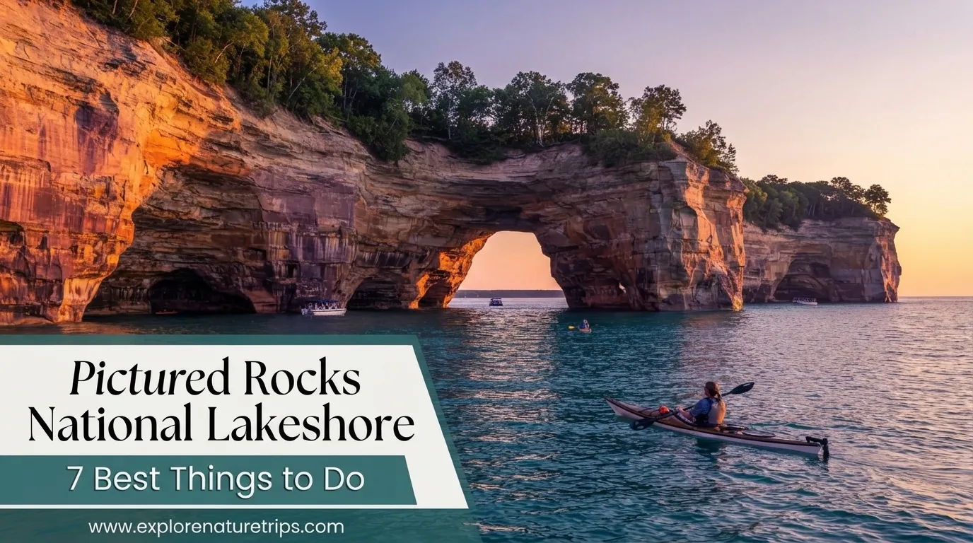
Pictured Rocks National Lakeshore is one of Michigan’s most memorable Lake Superior destinations, combining colorful sandstone cliffs, waterfalls, beaches, forests, dunes, inland lakes, and scenic trails in one long shoreline landscape.
The lakeshore stretches about 42 miles along Lake Superior in Michigan’s Upper Peninsula. It was established in 1966 as America’s first national lakeshore, making it significant not only for its scenery but also for its place in U.S. conservation history.
For travelers planning their first visit, the biggest challenge is deciding what to prioritize. The area offers hiking, waterfalls, boat cruises, kayaking, beaches, scenic overlooks, dunes, historic sites, and several smaller attractions.
The following 7 experiences bring together the strongest recommendations from the travel guides reviewed and provide a practical way to plan your visit.
1. See the Cliffs at Miners Castle
Miners Castle is one of the most recognizable landmarks at Pictured Rocks and one of the easiest major viewpoints to reach.
It is also the only cliff area in the park accessible by vehicle, making it a particularly useful first stop for visitors who do not want to begin with a long hike.
From the parking area, short paths lead to viewpoints overlooking Lake Superior and Grand Island. The area includes 3 viewing platforms, while the complete loop around the viewpoints is about 1/2 mile.
The upper viewing areas are relatively accessible, while reaching the lower overlook requires stairs and a steeper section.
Why Miners Castle is worth visiting
- Excellent introduction to the sandstone cliffs
- Short walking distance from parking
- Views of Lake Superior
- Views toward Grand Island
- Good option for families and visitors with limited hiking time
- Easy to combine with other Munising-area attractions
The formation has also changed over time. In 2006, one of Miners Castle’s two turrets fell into Lake Superior, demonstrating how erosion continues to reshape the shoreline.
For photographers, the changing light on the sandstone can make the same viewpoint look noticeably different during the day.
2. Hike the Chapel Basin and Chapel Loop Area
For visitors who want the classic Pictured Rocks hiking experience, the Chapel area deserves a top position on the itinerary.
The Chapel Loop combines forest, waterfalls, beaches, sandstone formations, and sections of the Lake Superior shoreline. The full loop is about 10 miles, with the National Park Service currently listing the complete route, including Mosquito Falls, at approximately 10.5 miles.
The route connects several important sights, including:
- Chapel Falls
- Chapel Rock
- Chapel Beach
- Pictured Rocks cliffs
- Mosquito River
- Mosquito Beach
- Mosquito Falls
This is much more demanding than simply visiting a scenic overlook, so allow enough time and carry sufficient water and food.
Important Chapel-area distances
| Trail or destination | Approximate distance |
|---|---|
| Chapel Falls | 2.5 miles round trip |
| Mosquito Falls | 2.0 miles round trip |
| Mosquito Beach | 3.9 miles round trip |
| Mosquito Beach loop | 4.5 miles |
| Chapel Rock & Chapel Beach | 6.2 miles round trip |
| Full Chapel Loop | 10–10.5 miles |
The Chapel area is especially valuable for travelers who want several experiences in one hike rather than visiting individual attractions by car.
Planning tip: Start early. Parking at the Chapel/Mosquito trailhead can become limited, and the route can be muddy and rough in places.
3. Explore the Waterfalls
Waterfalls are another major reason travelers visit Pictured Rocks. The waterfalls range from substantial cascades to smaller seasonal falls hidden within the forest.
Some are easy to reach, while others can be incorporated into longer hikes.
Miners Falls
Miners Falls is one of the most popular waterfall hikes.
The trail is approximately 1.2 miles round trip, and the waterfall drops about 50 feet over a sandstone cliff. Reaching the lower viewing area involves another 64 steps.
For travelers wanting a relatively short hike with a worthwhile payoff, Miners Falls is an excellent choice.
Munising Falls
Munising Falls is another convenient stop near Munising.
The waterfall is about 50 feet high, and the paved trail is approximately 800 feet one way to the main viewing platform.
Its short distance makes it suitable for visitors who do not want to commit to a multi-mile hike.
Chapel Falls
Chapel Falls provides another waterfall experience within the Chapel area.
The trail is approximately 2.5 miles round trip, with the waterfall reaching around 60 feet.
Mosquito Falls
Mosquito Falls is reached through the Chapel/Mosquito trail system.
The complete hike is approximately 2 miles round trip, with the highest of the short cascades measuring about 8 feet.
Waterfall comparison
| Waterfall | Approx. height | Trail distance |
|---|---|---|
| Miners Falls | 50 ft | 1.2 miles round trip |
| Munising Falls | 50 ft | 800 ft one way |
| Chapel Falls | 60 ft | 2.5 miles round trip |
| Mosquito Falls | 8 ft highest section | 2.0 miles round trip |
If your time is limited, choose waterfalls according to your preferred effort level rather than trying to visit every one.
4. Take a Boat Cruise or Go Kayaking
Seeing Pictured Rocks from land gives you only part of the experience. The cliffs extend directly along Lake Superior, so viewing them from the water reveals formations and waterfalls that can be difficult or impossible to see from trails.
The guides repeatedly highlight boat cruises and kayaking as major activities.
Typical Pictured Rocks cruises take approximately 2.5–3 hours, depending on the route and tour.
From the water, travelers can see features such as:
- Miners Castle
- Chapel Rock
- Chapel Beach
- Spray Falls
- Multicolored sandstone cliffs
- Lake Superior shoreline
- Other formations inaccessible from roads
Some cruises also offer sunset options.
Why a boat tour helps
A cruise is especially useful for visitors who:
- Have limited hiking time
- Want to see more shoreline in one activity
- Prefer photography from the water
- Are traveling with family members who cannot complete long hikes
- Want to combine sightseeing with a relaxing activity
Kayaking offers a more active alternative. However, Lake Superior weather can change quickly, so water-based activities require more attention to conditions.
A practical itinerary can combine a short hike with a 2.5–3 hour cruise instead of attempting multiple long trails on the same day.
5. Visit Grand Sable Dunes and Log Slide Overlook
The eastern side of Pictured Rocks offers a different landscape from the colorful cliffs around Munising.
At Grand Sable Dunes, enormous sand formations meet Lake Superior, creating broad scenic views.
One of the best-known viewpoints is Log Slide Overlook, where visitors can look across the dunes and lake.
The location also connects to the area’s logging history. The historic log slide was once used to move timber toward the lake.
The descent down the slide can take only a few seconds, but climbing back up the sandy slope can take an hour or more depending on conditions and fitness.
Why visit this area?
- Dramatic Lake Superior views
- Large dunes
- Different scenery from the western cliffs
- Historical connection to logging
- Excellent addition to a Grand Marais-area itinerary
The eastern side is particularly useful on a longer trip because it prevents your entire visit from being concentrated around Munising.
6. Walk the Beaches and Scenic Shoreline
Pictured Rocks is not only about cliffs and hiking trails. The shoreline includes beaches, forests, marshes, dunes, and quieter areas where visitors can slow down and enjoy Lake Superior.
Popular locations discussed by the travel guides include:
- Miners Beach
- Chapel Beach
- Mosquito Beach
- Sand Point Beach
- Twelvemile Beach
- Sand Point Marsh
- Grand Sable shoreline
The 42-mile lakeshore provides considerable variety, while more than 15 miles of cliffs form the most dramatic section.
Miners Beach
Miners Beach can be combined with the Miners Castle area. A section of the North Country Scenic Trail connects Miners Castle and Miners Beach.
The current park information lists the trail connection as approximately 2 miles round trip, making it a reasonable option for visitors who want to extend their Miners Castle stop.
Mosquito Beach
Mosquito Beach requires considerably more effort.
The direct out-and-back route is about 3.9 miles round trip, while the loop returning past Mosquito Falls is about 4.5 miles.
The trail can be muddy and rough, but the reward is a beautiful Lake Superior beach surrounded by sandstone cliffs and terraces.
Beach choice by travel style
| If you want… | Consider… |
|---|---|
| Easy scenic stop | Miners Beach |
| Beach during a longer hike | Chapel Beach |
| Cliffs and a more demanding walk | Mosquito Beach |
| Quiet shoreline scenery | Sand Point Beach |
| Dunes and Lake Superior | Twelvemile / Grand Sable area |
7. Add Au Sable Light Station and Grand Island
A longer Pictured Rocks trip should include at least one experience beyond the main cliff viewpoints.
The Au Sable Light Station combines scenery with Great Lakes maritime history. The lighthouse was built in 1874 and remains one of the notable historic structures associated with the lakeshore.
The hike to the lighthouse is approximately 3 miles round trip, depending on the route and starting point used.
For travelers staying several days, Grand Island is another worthwhile addition. It sits about 1/2 mile from mainland Munising and provides opportunities for hiking, biking, beaches, and camping.
One guide highlights approximately 20 miles of biking around Grand Island, making it an option for visitors who want to spend more time outdoors rather than simply making a short sightseeing stop.
Best Pictured Rocks Activities by Time Available
Not everyone needs a 5-day trip. Your ideal itinerary depends on how much time you have and how much hiking you want to do.
| Trip length | Priorities |
|---|---|
| 1 day | Miners Castle, one waterfall, short beach stop, boat cruise |
| 2 days | Add Miners Falls, Munising Falls, Grand Sable or Log Slide |
| 3 days | Add Chapel Basin or kayaking |
| 4 days | Add Au Sable Light Station and Grand Marais |
| 5 days | Explore the western and eastern sections at a slower pace |
A 5-day trip is particularly useful if you want to combine hiking, water activities, waterfalls, beaches, and the eastern portion of the lakeshore without rushing.
A Practical 5-Day Pictured Rocks Itinerary
The following plan combines the strongest itinerary themes from the guides.
Day 1: Munising and Miners Castle
Start around Munising and visit:
- Munising Falls
- Miners Castle
- Miners Beach
- Sand Point Beach
Finish with sunset if conditions are favorable.
This is a relatively flexible first day and does not require a long hike.
Day 2: Waterfalls and Boat Cruise
Spend the morning exploring:
- Miners Falls
- Miners Beach
- Nearby scenic areas
Reserve the afternoon or evening for a 2.5–3 hour Pictured Rocks cruise.
Seeing the cliffs from the water after exploring them from land creates a useful contrast.
Day 3: Chapel Basin
Dedicate the day to the Chapel/Mosquito area.
Depending on your fitness and available time, explore:
- Chapel Falls
- Chapel Rock
- Chapel Beach
- Mosquito Beach
- Mosquito Falls
- Pictured Rocks cliffs
The complete Chapel Loop can reach approximately 10.5 miles, so it should not be treated as a casual short walk.
Day 4: Grand Sable and Au Sable
Move toward the eastern side of the lakeshore.
Consider:
- Au Sable Light Station
- Log Slide Overlook
- Grand Sable Dunes
- Twelvemile Beach
- Grand Marais
This day provides a different landscape and helps you experience more of the 42-mile shoreline.
Day 5: Choose Your Favorite Experience
Use the final day according to your travel style.
Choose from:
- Kayaking
- Grand Island
- Another waterfall
- A beach morning
- Scenic driving
- Photography
- A shorter trail
- A second boat experience
This flexible day is useful because weather can affect cruises and kayaking.
Best Time to Visit Pictured Rocks
The guides highlight different seasons for different experiences.
Late spring
May through early June can provide stronger waterfall flow and fewer visitors, although trails may be muddy and insects can become an issue.
Summer
June through August is the most practical period for combining hiking, kayaking, boat cruises, beaches, and other activities.
Expect more visitors during this period.
Fall
Mid-September through early October is particularly attractive for fall colors.
Cooler conditions and changing foliage can make hiking especially scenic.
Winter
December through March offers a completely different experience, including snowshoeing and winter activities, although access and services differ from summer.
The park is open year-round, but not every attraction or activity operates the same way in every season.
How to Choose the Right Hikes
You do not need to complete the longest trail to experience Pictured Rocks.
Use your available energy as the deciding factor.
For a short outing
Choose:
- Munising Falls
- Miners Castle
- Short scenic viewpoints
- Beach stops
For moderate hiking
Consider:
- Miners Falls
- Chapel Falls
- Miners Castle to Miners Beach
- Au Sable Light Station
For a full-day hiking experience
Choose:
- Chapel Loop
- Chapel Rock and Chapel Beach
- Mosquito Beach Loop
- Beaver Basin Wilderness Loop
The Beaver Basin Wilderness Loop is approximately 5.5 miles and combines forest, Beaver Lake, Beaver Creek, and sections of the North Country Scenic Trail.
Practical Tips Before You Go
A little preparation can make a major difference at Pictured Rocks.
Start early
Popular trailheads, particularly around Chapel, can become busy. An early start also gives you more daylight for longer routes.
Carry enough water
Longer trails such as the Chapel Loop require more preparation than short waterfall walks.
Check the weather
Lake Superior can produce rapid weather changes. Rain, cool temperatures, and changing lake conditions can affect both hiking and water activities.
Bring a map
Cell service can be limited in portions of the lakeshore. A downloaded or physical map is useful for longer hikes.
Respect cliff edges
Stay on established trails and keep away from unstable edges. Sandstone cliffs and overlooks can be hazardous.
Plan water activities ahead
Boat cruises and kayaking are popular seasonal activities. Booking ahead is sensible, especially during summer.
Match the trail to your ability.
A 10.5-mile loop is a very different experience from an 800-foot waterfall walk. Build your schedule around realistic hiking distances rather than trying to visit everything.
Is Pictured Rocks Worth Visiting?
Yes, especially if you enjoy combining several types of outdoor experiences in one destination.
The biggest advantage is the variety. Within the same trip, you can see 50-foot waterfalls, colorful sandstone cliffs, beaches, dunes, historic structures, forests, and Lake Superior from both land and water.
You can also design the trip around your preferred activity level. A short visit can focus on Miners Castle and waterfalls, while a 5-day itinerary allows enough time for Chapel Loop, a cruise, Grand Sable, Au Sable Light Station, beaches, and additional activities.
The key is not to treat Pictured Rocks as one single attraction. The 42-mile lakeshore contains many different experiences, and choosing a few that match your available time will make the trip more enjoyable.
FAQs
How many days do you need at Pictured Rocks?
A 2–3 day trip can cover major highlights, while 5 days provides more time for hiking, cruises, beaches, waterfalls, Grand Sable, and the eastern side of the lakeshore.
What is the most popular thing to do at Pictured Rocks?
Miners Castle is one of the most recognizable and accessible attractions, while the Chapel Loop is one of the strongest choices for a full hiking experience.
How long is the Chapel Loop?
The Chapel Loop is commonly described as about 10 miles, while the National Park Service lists the complete loop including Mosquito Falls at approximately 10.5 miles.
How long is the Pictured Rocks boat tour?
Typical cruises discussed by the guides take approximately 2.5–3 hours, depending on the route.
How high is Miners Falls?
Miners Falls drops approximately 50 feet over a sandstone cliff.
How high is Munising Falls?
Munising Falls is approximately 50 feet high.
Can you see Pictured Rocks without hiking?
Yes. Miners Castle, boat cruises, beaches, scenic overlooks, and several short trails allow visitors to experience the area without completing a long hike.
What is the best season for Pictured Rocks?
June through September offers a strong combination of hiking and water activities. Mid-September through early October is especially attractive for fall colors.
Is Pictured Rocks open year-round?
Yes. The lakeshore is a year-round destination, although access, weather, road conditions, and available activities vary by season.
What should you not miss at Pictured Rocks?
For a first visit, prioritize Miners Castle, Chapel Loop, Miners Falls, a boat cruise, Grand Sable Dunes/Log Slide, a Lake Superior beach, and Au Sable Light Station if your schedule allows.
Final Thought
Pictured Rocks National Lakeshore rewards travelers who give themselves enough time to experience more than one viewpoint.
Start with the easily accessible highlights such as Miners Castle and Munising Falls, then add a longer experience such as the 10–10.5-mile Chapel Loop. A 2.5–3 hour boat cruise provides a completely different perspective, while Grand Sable Dunes and Au Sable Light Station expand the trip toward the eastern side.
Whether you have 1 day or 5 days, the best approach is to balance your itinerary between hiking, water, waterfalls, beaches, and scenic stops rather than trying to see everything at once.

Hi, I’m Marcus! I love exploring the outdoors and discovering incredible places. Through ExploreNatureTrips blog, I share my travel experiences, useful tips, and recommendations for the best sights, trails, and destinations to visit.