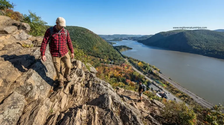
Gulf Hagas Maine: How to Reach It and What to Know Before You Go

Gulf Hagas is a remote wilderness destination in Bowdoin College Grant near Katahdin Iron Works, known for its rugged gorge, waterfalls, river pools, forests, and challenging trail conditions. The hike is not simply a short walk to a viewpoint. Depending on the route and side trails, hikers may cover roughly 8.5 to 9.5 miles and gain about 1,600 feet of elevation.
Most hikers should allow approximately 6 to 9 hours for the complete experience. That time can increase if you stop for photography, swimming, fishing, lunch, or exploring.
The biggest lesson is simple: do not underestimate the route. The terrain includes uneven ground, wet rocks, roots, steep sections, water crossings, and confusing side trails.
How to Reach Gulf Hagas
Getting to Gulf Hagas is part of the adventure. After leaving the paved roads, the approach follows Katahdin Iron Works Road through working forest toward the Lower Gulf Parking Area.
Road conditions can vary. Depending on recent grading, sections may be relatively smooth or quite bumpy, so visitors should not plan their arrival around normal highway driving speeds.
You also pass through the Katahdin Iron Works checkpoint, where day-use and camping arrangements are handled. The trailhead itself is remote rather than being a conventional visitor center with extensive facilities.
One account describes a drive of approximately 3.5 hours from Portland before reaching the Katahdin Iron Works area. Another hiking account describes approximately 1.5–2 hours from Bangor to the trailhead area. These are personal trip times, so your actual journey will depend on your starting point and road conditions.
What Happens at the Katahdin Iron Works Checkpoint?
The checkpoint is an important part of the approach.
Visitors should expect to:
- Check in before continuing.
- Follow access instructions.
- Deal with the applicable day-use fee.
- Make camping arrangements if staying overnight.
- Obtain or confirm useful route information.
- Prepare for an area where cell service may be unavailable.
One reported camping example involved 2 people staying for 2 nights and paying a little over $100. Because fees and regulations can change, treat historical prices as reference information rather than a guaranteed current rate.
Choosing a Gulf Hagas Route
There are multiple ways to approach the area, but one described loop begins at the Lower Gulf Parking Area, crosses the river, joins the Appalachian Trail, and eventually transitions onto the Gulf Hagas route.
The described loop continues along the Rim Trail toward the Head of Gulf before using the Pleasant Tote Road on the return.
A water crossing is part of the experience on the described approach. If you are uncomfortable with river crossings, wet rocks, or uneven terrain, this is something to consider before starting.
How Long Does the Gulf Hagas Hike Take?
A realistic planning window is 6–9 hours.
That estimate matters because Gulf Hagas is not only about walking distance. The route contains numerous places where hikers naturally stop to look at waterfalls, photograph the gorge, swim, fish, eat, or simply enjoy the river.
One documented hiking experience began at approximately 8:00 AM, reached the Head of Gulf at around 4:30 PM, and returned at approximately 6:00 PM.
That means the group spent roughly 10 hours between leaving and returning, despite the published typical hiking window being 6–9 hours. Their slower pace, stops, water problems, and route choices contributed to the longer day.
Planning tip: If you want to enjoy the scenery instead of rushing, leave early.
The Waterfalls and Major Sights
Gulf Hagas is packed with individual scenic points, so the journey feels more varied than the mileage alone suggests.
The major named features described in the available material include:
- Screw Auger Falls
- Hammond Street Pitch
- The Jaws
- Buttermilk Falls
- Billings Falls
- Stair Falls
- The Cathedral
- Head of the Gulf
Screw Auger Falls
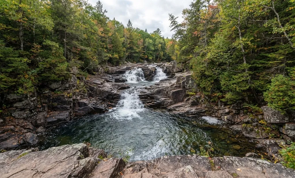
Screw Auger Falls is one of the first major waterfall experiences on the route described. Water moves through a narrow section of slate before reaching a deep pool.
The area is also associated with swimming, although the water is extremely cold and the surrounding rocks can be slippery.
The Jaws
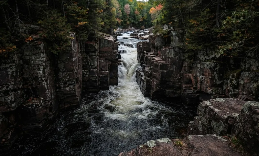
The Jaws is characterized by massive slate walls that narrow around the river. It is one of the places where the geological character of the gorge becomes especially obvious.
Its narrow channel and steep surroundings also demonstrate why hikers should remain on established routes rather than wandering onto unstable side paths.
Buttermilk Falls
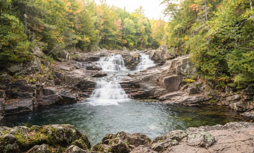
Buttermilk Falls differs from the larger plunge-style waterfall experience. Water moves across broad slate shelves in a series of smaller cascades.
The combination of dark rock and bright water creates another distinctive photography opportunity.
Billings Falls and Stair Falls
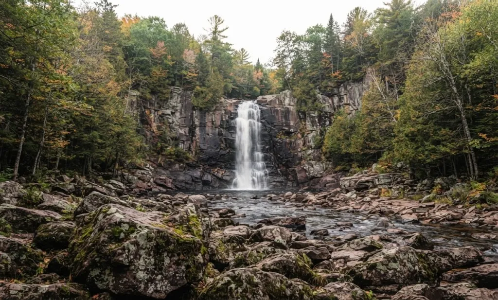
Billings Falls provides multiple viewing angles, while Stair Falls drops over a series of ledges that resemble a natural staircase.
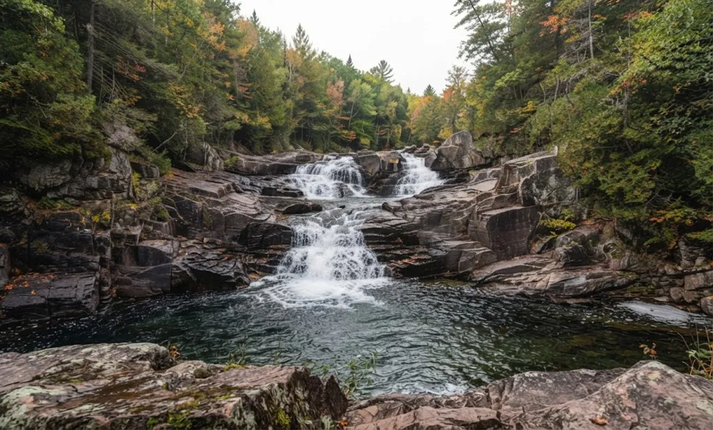
Rather than rushing from one waterfall to another, allow enough time to stop and appreciate the different shapes of the gorge.
The Cathedral and Head of the Gulf
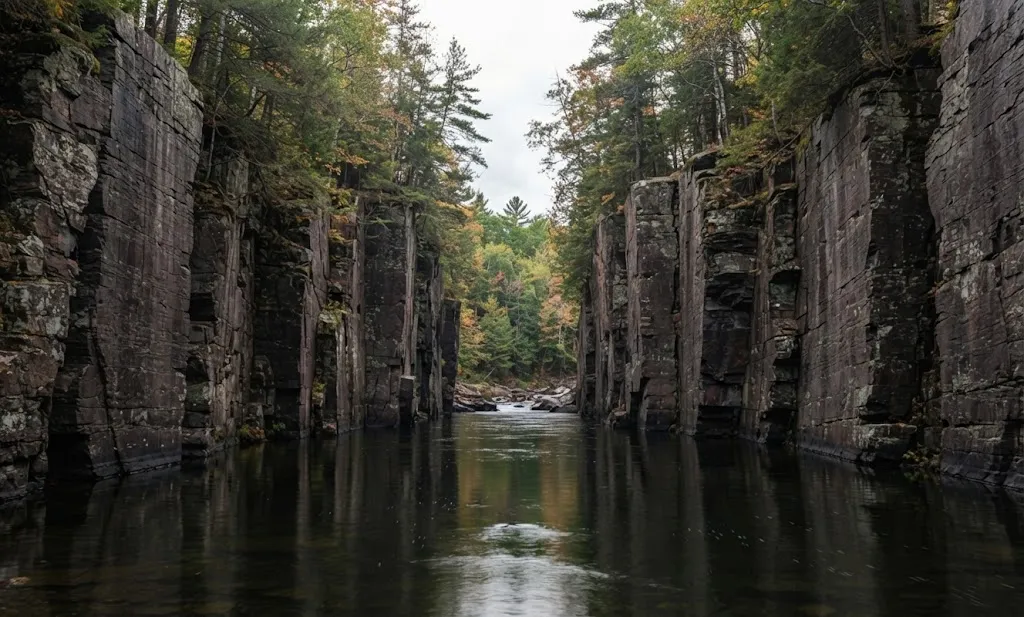
The Cathedral is one of the larger-feeling sections of the gorge, with high walls rising above the river.
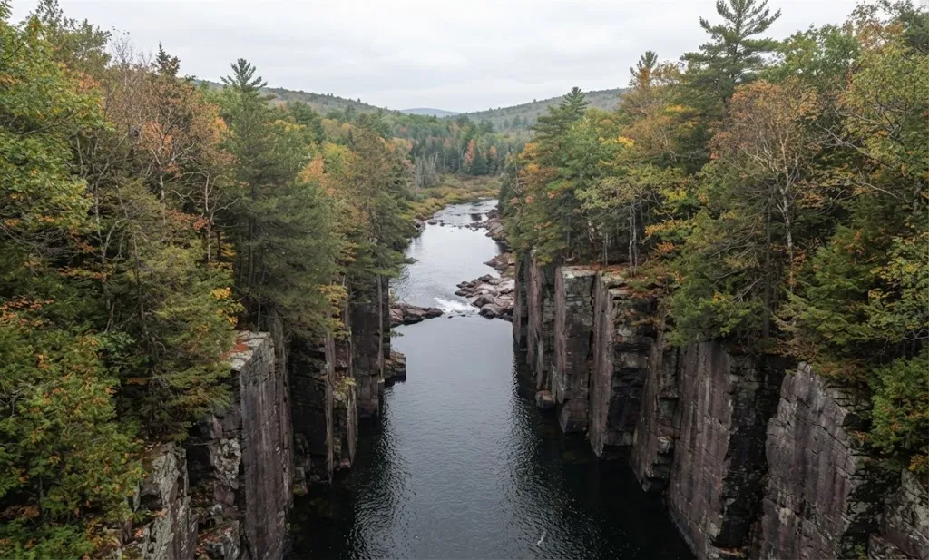
The Head of the Gulf represents the beginning of the gorge and offers a more open environment compared with some of the narrower waterfall sections.
Swimming at Gulf Hagas
Swimming is one of the attractions of the river, particularly around the plunge pools.
However, cold water and slippery rocks make good judgment essential. One source estimates the water at around 55°F during its described summer experience.
If you swim:
- Enter only calm water.
- Check the landing area first.
- Avoid jumping from high rocks.
- Never dive into unfamiliar pools.
- Remember that currents can be stronger than they appear.
- Keep your footing secure around wet slate.
The goal is to enjoy the water without turning a scenic stop into an avoidable emergency.
Fishing for Wild Brook Trout
Gulf Hagas also provides opportunities for fishing, particularly for wild brook trout.
One hiking account describes catching brook trout measuring approximately 6–8 inches. Another account describes catching roughly a dozen wild brook trout during the day.
A valid Maine fishing license is required, and fishing regulations can change. Anyone planning to fish should check the current rules before the trip and handle released fish carefully.
Why Water Is a Major Planning Issue
The river may be everywhere around you, but that does not mean you should rely on it for drinking water without proper treatment.
One hiking group carried 3.5 liters of water and still ran out before reaching the Head of Gulf.
That experience highlights an important lesson: carry enough water and have a reliable treatment method if your route and equipment allow it.
A compact water filter can be particularly useful because the route passes through an environment with flowing water.
What to Pack for Gulf Hagas
A practical packing list should focus on water, traction, weather protection, navigation, and the possibility of getting wet.
| Item | Why it matters |
|---|---|
| Plenty of water | The hike can last 6–9 hours |
| Water filter | Useful when treating suitable flowing water |
| Hiking shoes | Better traction on wet and uneven surfaces |
| Trekking poles | Additional stability on rough terrain |
| Swimsuit | Useful if you plan to swim |
| Dry bag | Protects electronics and clothing |
| Bug spray | Helpful in northern Maine |
| Lunch and snacks | This is a full-day outing |
| Map | Important where cell service is limited |
| Phone | Useful for offline navigation and emergencies |
| Extra layers | Conditions can change during a long day |
The most important preparation is not carrying the lightest possible pack. It is carrying what you actually need for a remote, challenging, full-day hike.
Footwear Matters More Than You Might Expect
The terrain includes wet rocks, exposed roots, loose sections, slate, and river crossings.
One hiking account describes blister and ankle problems after using open footwear for the trip. That experience reinforces why footwear with good grip and secure support is a practical choice for this route.
For most visitors, traction and stability should matter more than simply choosing the lightest footwear.
Cell Service and Navigation
Expect little to no cell service.
This changes how you should prepare. Do not assume that you can reach an online map whenever you need one.
Before leaving:
- Download maps for offline use.
- Carry a physical map when practical.
- Know your intended loop before starting.
- Pay attention to trail intersections.
- Stay on established paths.
- Do not blindly follow unmarked side trails.
One source specifically notes that side trails can become confusing and that hikers have required rescues in the area.
Stay on the Established Trail
This is one of the most important practical lessons.
The gorge contains steep terrain and numerous informal paths leading toward water and viewpoints. Some can become dangerous near cliffs and drop-offs.
The temptation to get closer to a waterfall or plunge pool can be strong, but a photograph is not worth creating an unnecessary fall hazard.
Stay on established routes whenever possible and enjoy viewpoints from safe positions.
Is Gulf Hagas Suitable for Beginners?
The available hiking guidance describes Gulf Hagas as challenging and specifically says it is not suitable for most children.
The difficulty comes from more than elevation. The terrain can remain uneven for long periods, and hikers must deal with water crossings, slippery rocks, roots, steep sections, and navigation concerns.
If you are new to hiking, choosing a shorter and less remote trail may make it easier to build experience before attempting a route of this length and difficulty.
Can You Bring a Dog?
Dogs are permitted, although the route is better suited to experienced hiking dogs.
The combination of rough terrain, water crossings, slippery rocks, and a potential 6–9-hour day means owners should consider their dog’s fitness, age, confidence, and ability to handle uneven ground.
Older dogs or dogs that struggle with rough terrain may have a particularly difficult day.
Camping Near Gulf Hagas
Gulf Hagas can be incorporated into a longer trip rather than treated solely as a day hike.
The Appalachian Trail passes through the broader area, while nearby camping possibilities include:
- West Branch Pleasant River Campground
- Silver Lake Campground
- High Bridge Campground
- Hay Brook Campground
For vehicle-based camping, visitors can check in at the Katahdin Iron Works checkpoint and ask about available nearby public campgrounds.
Camping availability and rules should be confirmed before traveling because conditions and regulations can change.
A Simple Gulf Hagas Day Plan
For a full-day visit, a practical schedule can look like this:
Before 8:00 AM
Arrive prepared with water, food, navigation, appropriate footwear, and weather protection.
Around 8:00 AM
Begin the hike early enough to leave plenty of daylight for the route.
Morning
Move through the forest and approach the gorge, taking time at major viewpoints rather than rushing.
Midday
Enjoy the waterfalls, river scenery, and suitable swimming or fishing areas.
Afternoon
Continue toward the Head of Gulf and begin planning your return based on your pace and remaining daylight.
Late afternoon
Use the return route and avoid committing to unfamiliar terrain after dark.
A documented trip began at 8:00 AM, reached the Head of Gulf around 4:30 PM, and returned around 6:00 PM.
Leave No Trace at Gulf Hagas
The wilderness character of Gulf Hagas is part of what makes the area special.
Visitors should:
- Pack out all trash.
- Stay on established trails.
- Avoid creating new viewpoints.
- Leave plants and wildflowers where they grow.
- Observe wildlife from a safe distance.
- Handle fish carefully.
- Respect river and shoreline vegetation.
- Leave the area as close as possible to its natural condition.
Responsible recreation helps protect the experience for future visitors.
Gulf Hagas FAQs
How many miles is the Gulf Hagas hike?
The described loop is approximately 8.5–9.5 miles, depending on side trails. Another hiking account records a route of 7.9 miles, while a personal trip measured approximately 8.2 miles. Route choices can explain differences in reported mileage.
How long does Gulf Hagas take?
Most hikers should plan for approximately 6–9 hours. A documented hiking experience lasted substantially longer because of a slow pace, stops, swimming, fishing, and route conditions.
How difficult is Gulf Hagas?
It is described as challenging, with approximately 1,600 feet of elevation gain and difficult footing. Uneven terrain, water crossings, wet rocks, and steep sections contribute to the difficulty.
Can you swim at Gulf Hagas?
Yes. Several plunge pools provide swimming opportunities, but the water can be very cold and rocks may be slippery. Avoid diving and jumping from unsafe heights.
Can you fish at Gulf Hagas?
Yes. The area supports wild brook trout. A Maine fishing license is required, and visitors should follow current fishing regulations.
Is there cell service?
Expect little to none. Download maps before leaving and consider carrying a physical map.
Are dogs allowed?
Yes, experienced hiking dogs can accompany visitors. However, rough terrain and a long hiking day may be difficult for older or less capable dogs.
What is the best time to visit?
The hiking source lists late June through October as the best season. Conditions can still vary, so visitors should check current weather and access information before traveling.
Final Planning
Gulf Hagas rewards preparation. The combination of an 8.5–9.5-mile route, approximately 1,600 feet of elevation gain, 6–9 hours of expected hiking, remote access, limited cell service, water crossings, slippery terrain, waterfalls, swimming pools, and fishing opportunities makes it much more than a casual walk.
Start early, carry sufficient water and food, use dependable footwear, download your maps, stay on established trails, and leave enough daylight for the return.
Most importantly, treat the gorge with respect. Its beauty comes with real wilderness conditions, and a well-prepared visit gives you much more time to enjoy the waterfalls, river, forest, and dramatic rock formations without unnecessary problems.

Hi, I’m Marcus! I love exploring the outdoors and discovering incredible places. Through ExploreNatureTrips blog, I share my travel experiences, useful tips, and recommendations for the best sights, trails, and destinations to visit.