Hiking Trails on the Northern California Coast: 10 Scenic Routes to Explore
Hiking Trails on the Northern California Coast
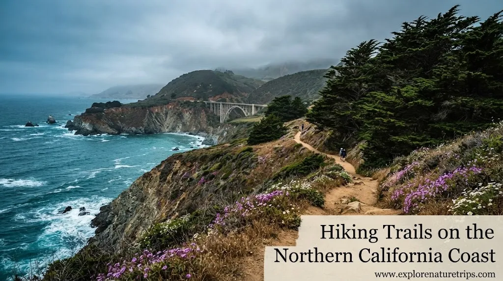
The Northern California coast is one of the most varied hiking regions in the state. Stretching roughly 500 miles from the San Jose area toward the Oregon border, the coastline combines dramatic cliffs, sandy beaches, giant redwoods, waterfalls, grasslands, sea views, and quiet forest trails.
There is no single type of coastal hike here. You can take an easy 1-mile walk through redwoods, tackle a moderate 8-mile waterfall route, or spend multiple days on a challenging 25-mile Lost Coast Trail adventure.
This guide brings together the most useful information from popular Northern California hiking recommendations and organizes it around what hikers actually need to know: distance, difficulty, scenery, elevation, parking, dogs, seasonal considerations, and trail experience.
Northern California Coast Hikes: 10 Scenic Routes Waiting for You Below
1. Lost Coast Trail
The Lost Coast Trail is the choice for hikers looking for a much more serious coastal adventure. The route between Mattole and Black Sands Beach is approximately 25 miles, making it roughly marathon-length.
Unlike a short coastal walk, this trail is better suited to experienced hikers and overnight campers. Its remote character is a major part of the appeal.
What makes it special
The Lost Coast combines rugged coastal scenery with a feeling of isolation that is difficult to find on more developed California trails. The Lost Coast is located roughly 100 miles south of the Oregon border.
Outdooractive lists a comparable Lost Coast route at 40.9 km, with an estimated hiking time of 10 hours 26 minutes and approximately 175 m of elevation gain and 171 m of elevation loss.
Best suited to
- Experienced hikers
- Overnight trips
- Long-distance hiking
- Remote coastal scenery
- Hikers comfortable planning a demanding route
Difficulty: Challenging
Distance: About 25 miles
Route: Mattole → Black Sands Beach
2. Tomales Point Trail
Located in Point Reyes National Seashore, Tomales Point Trail is a 9.4-mile moderate hike with wide-open coastal scenery.
The route passes through grasslands and coastal bluffs, while tule elk are one of its most notable attractions. Elk can be seen throughout the year.
Helpful timing tip
The trail can be foggy, and the guide recommends considering a start after 11 AM when conditions allow. That makes timing an important part of the experience rather than simply treating the trail as a distance challenge.
Why hikers choose it
- 9.4-mile route
- Moderate difficulty
- Year-round elk opportunities
- Coastal bluffs
- Open grasslands
- Strong wildlife appeal
Point Reyes National Seashore is also notable for having more than 150 miles of trails, so Tomales Point can be part of a much larger hiking itinerary.
3. Alamere Falls via Palomarin Trailhead
For hikers who want a combination of coastline, lakes, forest, and a waterfall, Alamere Falls is one of the standout options.
The route from the Palomarin Trailhead near Bolinas covers about 8.2 miles and is rated moderate.
Along the way, hikers encounter coastal lake overlooks, pockets of redwood forest, and the waterfall that reaches the sand.
Plan your start carefully
Weekend parking can become an issue, so arriving before 9 AM is recommended.
That small planning detail can make the difference between beginning your hike smoothly and spending extra time dealing with parking.
Distance: 8.2 miles
Difficulty: Moderate
Location: Bolinas
Highlight: Waterfall reaching the beach
4. Bridge Creek Trail to Maple Falls
If your ideal hike involves redwoods, ferns, moss, creeks, and waterfalls, Bridge Creek Trail to Maple Falls deserves attention.
The trail is located in Forest of Nisene Marks State Park near Aptos and covers about 8 miles with approximately 950 feet of elevation gain.
It is rated moderate and includes around 15 creek crossings, which become an important part of the adventure.
Trail details
| Feature | Information |
|---|---|
| Distance | 8 miles |
| Elevation gain | 950 feet |
| Difficulty | Moderate |
| Creek crossings | ~15 |
| Entrance/parking | $8 |
| Dogs | No |
| Strollers | No |
| Recommended season | January–March |
| Suggested timing | Mid-week |
The route was rated 10/10 in the family hiking ranking you provided, making it one of the strongest choices for hikers who value forest scenery over open coastal views.
5. Mt. Umunhum
Mt. Umunhum offers a different type of Northern California hiking experience. Instead of staying directly beside the ocean, the 7.7-mile route takes hikers into the Santa Cruz Mountains near Los Gatos.
The hike has approximately 1,187 feet of elevation gain, making it a moderate challenge.
At an elevation of 3,486 feet, the mountain is especially attractive for hikers looking for expansive views.
What you can see
The reported panorama can extend from the Pacific Ocean toward the Sierra Nevada, creating a much broader viewpoint than a typical coastal trail.
| Detail | Information |
|---|---|
| Distance | 7.7 miles |
| Elevation gain | 1,187 feet |
| Difficulty | Moderate |
| Mountain elevation | 3,486 feet |
| Dogs | No |
| Parking | Limited |
| Rating | 7.67/10 |
The trail information also notes that the area opened to the public in 2017.
6. Wapama Falls
At Hetch Hetchy in Yosemite, Wapama Falls combines a relatively manageable distance with dramatic mountain scenery.
The route is approximately 5 miles with only 200 feet of elevation gain and is rated moderate.
The major visual attractions are Hetch Hetchy Reservoir, granite walls, and Wapama Falls.
Why it stands out
This hike is particularly appealing if you want a route where the surrounding landscape is almost as important as the trail itself.
The family hiking ranking gave Wapama Falls a 10/10 rating.
| Detail | Information |
|---|---|
| Distance | 5 miles |
| Elevation gain | 200 feet |
| Difficulty | Moderate |
| Dogs | No |
| Strollers | No |
| Parking | Free |
| Rating | 10/10 |
7. Russian Gulch Waterfall Loop
Near Mendocino, Russian Gulch State Park offers one of the more accessible combinations of forest and waterfall scenery.
The Waterfall Loop is reported at approximately 3 to 3.8 miles, depending on the route description. The detailed trail information gives it a 3-mile figure, while another ranking lists 3.8 miles.
The hike passes through ferns, redwoods, and Russian Gulch Creek, with the waterfall serving as the main attraction.
Other things to explore
The park also provides opportunities for additional coastal hiking toward sea caves and Devil’s Punchbowl.
One ranking rated the trail 7.5/10 and mentioned an $8 entrance fee.
Distance: 3–3.8 miles
Difficulty: Easy
Location: Mendocino
Rating: 7.5/10
Main highlights: Waterfall, creek, ferns, redwoods
8. Lands End Coastal Trail
For hikers who want coastal scenery without committing to a full-day wilderness adventure, Lands End Coastal Trail in San Francisco is an excellent option.
The route is approximately 3.4 miles and is rated easy.
Its location makes it particularly convenient for visitors who want to combine hiking with sightseeing around San Francisco.
Highlights
- Golden Gate Bridge viewpoints
- Coastal scenery
- Hidden labyrinth
- Easy hiking
- Suitable for groups and families
- Attractive for sunrise walks
- Interesting photography opportunities in fog
Because the trail is relatively short, it works well when you want to experience the coast without dedicating an entire day to hiking.
9. Batteries to Bluffs Trail
Also located in San Francisco, Batteries to Bluffs provides a more active coastal experience than a simple flat walk.
The route covers approximately 3.5 miles, with around 450 feet of elevation gain and about 470 stairs.
The trail was rated 7.25/10 in the family hiking ranking.
What you’ll see
The route offers views of:
- Golden Gate Bridge
- Marin Headlands
- Pacific Ocean
- Historic batteries
The trail is rated moderate, and a recommended minimum age of 5 years was also given in the family-focused guide.
10. Fern Canyon
If you are looking for one of the easiest ways to experience the redwood region, Fern Canyon at Prairie Creek Redwoods State Park is hard to overlook.
The hike is approximately 1 mile and is described as easy and beginner-friendly.
The surrounding redwood landscape makes the short distance feel much more significant than the mileage suggests.
A memorable visit
The hiking guide notes that the author finally visited Fern Canyon in 2022, after missing it on 3 previous occasions.
There is also a Gold Bluffs Beach campground nearby, making the area useful for hikers who want to combine a short trail with a coastal camping experience.
Distance: 1 mile
Difficulty: Easy
Best for: Beginners, short hikes, redwood scenery
More Northern California Coastal Trails Worth Considering
The region has far more options than the 10 highlighted above. Several additional trails from the hiking sources stand out for specific interests.
Montgomery Grove Trail
Located in Montgomery Woods State Natural Reserve near Ukiah, this easy trail covers about 1.8 miles with 282 feet of elevation gain.
It focuses on giant redwoods and was presented as a family-friendly Mendocino-area experience.
Twin Peaks
The Twin Peaks route in San Francisco is approximately 2.1 miles, with 272 feet of elevation gain, and is rated easy.
Dogs are allowed, parking is free, and restrooms are available according to the ranking.
The reported rating is 7.6/10.
Uvas Waterfall Loop
Near Gilroy, the Uvas Waterfall Loop covers about 1.8 miles with 620 feet of elevation gain.
The route features 3 waterfalls:
- Black Rock Falls
- Basin Falls
- Upper Falls
The trail is rated easy, and a longer alternative is approximately 3.5 miles.
Entry was listed at $6 per car, with reservations required.
Slacker Hill
In the Marin Headlands, Slacker Hill is approximately 3.3 miles with 810 feet of elevation gain.
Despite the elevation gain, it was rated easy in the family ranking and received an 8/10 rating.
Views include the Golden Gate Bridge, Fort Baker, Cavallo Point, Angel Island, Belvedere, and the Pacific Ocean.
Coastal Beach Hikes by Distance
Not every Northern California coastal hike needs to be a long adventure. The beach-hiking database you provided includes many short routes.
The important point is that the listed mileage is often one-way distance, meaning hikers should double it when estimating a round trip.
| Beach / Trail | County | One-Way Distance |
|---|---|---|
| Franklin Point Beach | San Mateo | ⅔ mile |
| Point Ano Nuevo | San Mateo | 1.25 miles |
| Cowell Ranch Beach | San Mateo | ⅗ mile |
| Thornton State Beach | San Mateo | ¾ mile |
| Mile Rock Beach | San Francisco | 1 mile |
| Kirby Cove Beach | Marin | 1 mile |
| Tennessee Cove Beach | Marin | 2 miles |
| Pirates Cove Beach | Marin | 2 miles |
| Palomarin Beach | Marin | 1 mile |
| Sculptured Beach | Marin | 4 miles |
| Abbotts Lagoon Beach | Marin | 1.5 miles |
| Marshall Beach | Marin | 1 mile |
| Shorttail Gulch Beach | Sonoma | 1-mile loop |
| Alder Creek | Mendocino | 1 mile |
| Point Cabrillo Light Station Beach | Mendocino | ¾ mile |
| Fleener Creek Beach | Humboldt | ½ mile |
| Carruthers Cove Beach | Humboldt | 1 mile |
| Hidden Beach | Del Norte | 0.5, 1 or 3 miles |
| Damnation Creek | Del Norte | 2 miles |
| Enderts Beach | Del Norte | ¾ mile |
For a short outing, routes such as Fleener Creek Beach, Hidden Beach, Enderts Beach, and Fern Canyon can be much more approachable than the region’s longer backcountry routes.
Northern California Coast Hiking by Difficulty
Choosing a trail based on distance alone can be misleading. A 3-mile route with steep sections or hundreds of stairs may feel harder than a longer, flatter trail.
Easy hikes
Good choices for a relaxed outing include:
- Fern Canyon — 1 mile
- Lands End Coastal Trail — 3.4 miles
- Russian Gulch Waterfall Loop — 3–3.8 miles
- Montgomery Grove Trail — 1.8 miles
- Twin Peaks — 2.1 miles
- Uvas Waterfall Loop — 1.8 miles
- Slacker Hill — 3.3 miles
- Bodega Head Trail — 1.7 miles
Moderate hikes
For hikers wanting more distance or elevation:
- Tomales Point Trail — 9.4 miles
- Alamere Falls — 8.2 miles
- Bridge Creek to Maple Falls — 8 miles
- Mt. Umunhum — 7.7 miles
- Wapama Falls — 5 miles
- Batteries to Bluffs — 3.5 miles
- The Lost Coast Trail — approximately 25 miles, although it represents a much more demanding experience
Harder options
The broader Northern California hiking recommendations also include routes such as Mist Trail to Nevada Falls in Yosemite, listed at approximately 8–9 miles with around 2,000 feet of elevation gain.
The route features Vernal Falls and Nevada Falls, along with stairs, forest, granite, and seasonal snow.
Outdooractive also lists several demanding Redwood National and State Parks routes, including one at 28.7 km with approximately 742 m of elevation gain.
Best Trails for Specific Hiking Goals
Best for redwoods
Choose Fern Canyon, Montgomery Grove Trail, or the trails around Redwood National and State Parks.
Fern Canyon is particularly attractive if you want a short route, while Montgomery Grove provides a longer redwood-focused walk.
Best for waterfalls
Consider:
- Russian Gulch Waterfall Loop
- Alamere Falls
- Wapama Falls
- Uvas Waterfall Loop
- Bridge Creek Trail to Maple Falls
Uvas is especially interesting because its route includes 3 waterfalls.
Best for Golden Gate Bridge views
Two strong choices are:
- Lands End Coastal Trail
- Batteries to Bluffs
Batteries to Bluffs adds historic batteries, approximately 470 stairs, and 450 feet of elevation gain.
Best for wildlife
Tomales Point Trail is a strong option because of its year-round tule elk opportunities.
Best for a serious adventure
For experienced hikers, the Lost Coast Trail stands apart with its approximately 25-mile route and overnight-hiking potential.
How to Choose the Right Trail
Before selecting a hike, consider more than the headline distance.
1. Check the total distance
A trail listed as 1 mile one way may require about 2 miles for a return journey.
This distinction is particularly important when planning beach hikes.
2. Look at elevation gain
Distance doesn’t tell the whole story.
For example, Mt. Umunhum covers 7.7 miles but includes about 1,187 feet of elevation gain, while Wapama Falls covers 5 miles with approximately 200 feet of gain.
3. Consider stairs and terrain
Batteries to Bluffs has approximately 470 stairs, while Bridge Creek to Maple Falls includes around 15 creek crossings.
These details can matter more than mileage for some hikers.
4. Think about your group
If you’re hiking with children, older family members, or inexperienced hikers, an easy 1–3 mile route may be more enjoyable than forcing everyone onto a longer trail.
5. Check parking requirements
Parking can influence the entire experience.
For example, the Alamere Falls guide recommends arriving before 9 AM on weekends, while Mt. Umunhum is described as having limited parking.
6. Match the trail to the season
Some hikes have particularly useful seasonal considerations.
Tomales Point: elk can be seen year-round.
Alamere Falls: an early weekend start helps with parking.
Bridge Creek to Maple Falls: January–March is specifically recommended in the source.
Bodega Head: whale watching is highlighted from December–April.
Northern California Coastal Hiking by Region
The coastal hiking experience changes considerably as you move between counties and landscapes.
| Region | Notable Hiking Experiences |
|---|---|
| San Francisco | Lands End, Batteries to Bluffs, Twin Peaks |
| Marin County | Tomales Point, coastal beaches, Slacker Hill |
| Sonoma County | Shorttail Gulch, Bodega Head |
| Mendocino County | Russian Gulch, Montgomery Grove |
| Humboldt County | Redwood forests, Big Flat Beach, Spanish Flat |
| Del Norte County | Hidden Beach, Damnation Creek, Enderts Beach |
| Lost Coast | Long-distance coastal hiking |
This geographic approach can be especially useful for road trips because you can group several hikes into the same part of the coast rather than crossing large distances for every trail.
Trail Ratings and Traveler Popularity
Not every hiking resource measures trails in the same way.
Some guides use personal experience, while others use family rankings, structured hiking data, or traveler reviews.
For example, the family ranking gave Bridge Creek Trail to Maple Falls and Wapama Falls a 10/10, while Slacker Hill received 8/10 and Russian Gulch received 7.5/10.
Traveler-review platforms provide a different type of information. The supplied Tripadvisor data lists:
| Attraction | Rating | Reviews |
|---|---|---|
| Stout Grove | 4.9/5 | 758 |
| Lady Bird Johnson Grove | 4.8/5 | 272 |
| Fort Bragg Coastal Trail | 4.7/5 | 240 |
| Castle Lake | 4.7/5 | 97 |
| Jedediah Smith Redwoods State Park | 4.8/5 | 1,617 |
| Glass Beach | 3.8/5 | 2,227 |
| Avenue of the Giants | 4.9/5 | 1,027 |
These figures are useful as social proof, but they should not be treated as a substitute for checking trail distance, difficulty, weather, parking, and current conditions.
A Simple Northern California Hiking Plan
If you are planning a coastal road trip, you don’t necessarily need to complete the longest trails.
A balanced itinerary could combine different types of experiences:
Short redwood hike: Fern Canyon — 1 mile
Scenic coastal hike: Lands End — 3.4 miles
Waterfall experience: Russian Gulch — 3–3.8 miles
Longer coastal adventure: Tomales Point — 9.4 miles
Serious multi-mile adventure: Lost Coast Trail — about 25 miles
This approach gives you variety without making every day of the trip physically demanding.
FAQs
What are the best hiking trails on the Northern California coast?
Some of the strongest options include Lost Coast Trail, Tomales Point Trail, Alamere Falls, Bridge Creek to Maple Falls, Russian Gulch Waterfall Loop, Lands End, Batteries to Bluffs, and Fern Canyon.
The best choice depends on whether you prefer redwoods, waterfalls, beaches, wildlife, viewpoints, or long-distance hiking.
What is the easiest Northern California coastal hike?
Fern Canyon is one of the easiest options in the supplied hiking guides, at approximately 1 mile and described as beginner-friendly.
Other easy options include Lands End, Russian Gulch, Montgomery Grove, and Twin Peaks.
What is the longest hike in this guide?
The Lost Coast Trail is the longest major route highlighted, at approximately 25 miles between Mattole and Black Sands Beach.
It is better suited to experienced hikers and overnight campers.
Which trail is best for redwood scenery?
Fern Canyon is an excellent short option, while Montgomery Grove Trail and trails in Redwood National and State Parks provide additional redwood-focused experiences.
Which Northern California trail has the most waterfalls?
Uvas Waterfall Loop is notable because it passes 3 waterfalls: Black Rock Falls, Basin Falls, and Upper Falls.
Are dogs allowed on all Northern California coastal trails?
No. Dog rules vary by trail.
For example, dogs are listed as not allowed on Mt. Umunhum, Slacker Hill, Bridge Creek to Maple Falls, Wapama Falls, and Mist Trail to Nevada Falls, while Twin Peaks allows dogs.
Always check the current rules before setting out.
What Northern California coastal trail is best for families?
Short, easy routes such as Fern Canyon, Lands End, Russian Gulch, Montgomery Grove, and Twin Peaks can be more suitable for families than long or highly elevated hikes.
Batteries to Bluffs was given a recommended minimum age of 5 years in one family-focused guide.
When is the best time to hike the Northern California coast?
It depends on the trail and your goal. The supplied guides mention January–March for Bridge Creek to Maple Falls, while whale watching around Bodega Head and other coastal locations is highlighted during December–April.
Fog can also influence coastal visibility, so checking conditions before departure is important.
Final Thoughts
The best hiking trails on the Northern California coast are not defined by one distance or difficulty level. The region offers everything from a 1-mile beginner-friendly redwood walk to a 25-mile remote coastal adventure.
For waterfalls, try Russian Gulch, Uvas, Wapama Falls, or Bridge Creek. For ocean views, consider Lands End, Tomales Point, or Batteries to Bluffs. For giant redwoods, Fern Canyon and Montgomery Grove are strong choices. And if you’re prepared for a serious adventure, the Lost Coast Trail offers an entirely different experience.
The key is to choose a trail that matches your time, fitness, group, terrain preference, and hiking experience. With so many options spread across the Northern California coastline, you can build an itinerary around the scenery you want to experience rather than simply chasing the longest trail.

Hi, I’m Marcus! I love exploring the outdoors and discovering incredible places. Through ExploreNatureTrips blog, I share my travel experiences, useful tips, and recommendations for the best sights, trails, and destinations to visit.