
Grand Staircase-Escalante Hikes: 14 Best Trails & Guide
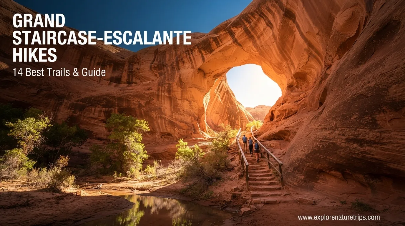
Grand Staircase-Escalante National Monument is a huge, remote landscape in southern Utah where sandstone canyons, slot canyons, arches, waterfalls, washes, and unusual rock formations create an exceptional range of hiking experiences.
The monument covers more than 1 million acres, and its scale matters when planning a hiking day. Trailheads can be separated by long stretches of dirt or rocky road, while some routes require navigation skills, river crossings, high-clearance vehicles, or 4WD.
The best approach is not simply choosing the longest or most famous trail. Instead, match the hike to your available time, vehicle, hiking experience, road conditions, and comfort with water or narrow canyon sections.
Among these guides, several destinations repeatedly stand out, including Coyote Gulch, Golden Cathedral, Zebra Slot Canyon, Peek-a-Boo and Spooky, Lower Calf Creek Falls, Cosmic Ashtray, Boulder Mail Trail, Toadstool Hoodoos, Escalante Natural Bridge, Willis Creek, and Devil’s Garden.
1. Coyote Gulch and Jacob Hamblin Arch
Coyote Gulch is one of the most iconic hiking destinations in Grand Staircase-Escalante. Its orange canyon walls, water, arches, and natural bridges create a very different environment from the surrounding desert.
The route can range from approximately 5 to 17 miles, depending on the selected trailhead and destination. The Two Outliers guide lists about 780 feet of elevation gain and rates the hike moderate.
There are 4 possible trailheads, which makes route selection particularly important. The area includes several notable sights:
- Jacob Hamblin Arch
- Coyote Nature Bridge
- Secret Lagoon
- Steven’s Arch
- Escalante River
The Nature Seeker notes that several of these sights can be combined within roughly a 10-mile Coyote Gulch outing.
Because access roads vary, check your route before leaving. Coyote Gulch is better suited to hikers who are comfortable with remote terrain, route planning, and changing conditions.
2. Golden Cathedral and Neon Canyon
Golden Cathedral is one of the most demanding and rewarding hikes in the collection.
Two Outliers gives its route from Egypt Trailhead as approximately 10.5 miles, with 1,500 feet of elevation gain and an estimated 6–8 hours. The trail is rated hard, while the Nature Seeker describes another route at a little over 6 miles. The difference demonstrates why the exact trailhead and route should always be checked before starting.
Access is a major part of the challenge:
- About 17 miles down Hole-in-the-Rock Road
- Then approximately 9 miles along Egypt Road
- The final 5 miles are particularly rough
- 4WD and high clearance are required according to Two Outliers
- The hike includes 5 river crossings
- Crossings can reach knee-to-hip depth
The route is also not consistently marked, making offline navigation especially important.
This is not the trail to choose simply because you want a scenic photo. The road approach, navigation, sand, and water crossings make it a serious desert adventure.
3. Cosmic Ashtray
The Cosmic Ashtray is one of the area’s strangest geological destinations.
Two Outliers lists the hike at 8.3 miles, with 880 feet of elevation gain, 5–6 hours of estimated hiking time, and moderate difficulty. Route-finding skills are required because there is no conventional marked trail leading all the way to the formation.
The recommended route starts from Spencer Flat Road.
The final formation is especially unusual because hikers can descend into the giant rock formation using footholds carved into the rock. A rope is not considered necessary by the guide, although it may make the climb easier because the footholds can be slippery.
For this hike, navigation is just as important as physical endurance.
4. Zebra Slot Canyon
Zebra Slot Canyon is known for its distinctive striped sandstone walls and extremely narrow canyon environment.
The Two Outliers guide lists:
- 5.2 miles
- 400 feet elevation gain
- 3–4 hours
- Moderate to difficult
- Approximately 1.4 additional miles for Tunnel Canyon
The approach includes about an 8-mile drive on a bumpy dirt road, followed by approximately 2.5 miles of hiking before reaching the canyon mouth.
Inside Zebra Slot Canyon, water can range from a few inches to a few feet deep. The canyon itself is only about 0.25 mile long, but squeezing and scrambling through the narrow section makes it much more challenging than its short length suggests.
The Nature Seeker also warns that the canyon can contain very cold water.
5. Peek-a-Boo and Spooky Slot Canyons
For hikers looking for a tighter slot-canyon experience, Peek-a-Boo and Spooky Gulch are among the standout choices.
The Nature Seeker lists approximately 5 miles for both canyons and rates the hike hard.
Two Outliers lists a 4.2-mile route plus approximately 0.8 mile through Dry Fork Narrows, with around 600 feet of elevation gain and 3–4 hours of estimated time.
AllTrails currently lists the Peekaboo and Spooky route at 6.3 miles and hard difficulty, illustrating again that route selection can change the total distance.
The biggest issue is not mileage. It is space.
Spooky Gulch becomes extremely narrow, so hikers uncomfortable with confined spaces should choose a different trail.
6. Lower Calf Creek Falls
If you want a more approachable combination of scenery and hiking, Lower Calf Creek Falls is one of the strongest choices.
AllTrails lists the route at 6.1 miles, approximately 531 feet of elevation gain, moderate difficulty, and an estimated 2 hours 17 minutes. Its page also reports a 4.8-star rating from 6,796 reviews in the indexed result.
The Nature Seeker describes the hike as 5–6 miles and notes that no 4WD is required. The waterfall is more than 100 feet high.
The trail also passes through sandy terrain, so appropriate footwear and plenty of water are important.
This is one of the better choices for hikers who want a major natural feature without committing to a highly technical canyon route.
7. Upper Calf Creek Falls
Upper Calf Creek Falls offers a shorter alternative.
The Two Outliers guide lists approximately 2.1 miles, 600 feet of elevation gain, moderate difficulty, and 1–2 hours. Anne’s Travels gives a very similar figure of 2.2 miles round trip.
The destination includes a waterfall and swimming-hole environment, making it particularly attractive when conditions are suitable.
Because this is a shorter hike than Lower Calf Creek Falls, it can work well when you have limited time but still want a waterfall-focused outing.
8. Escalante Natural Bridge
The Escalante Natural Bridge route combines river scenery, rock formations, and additional archaeological and geological features.
The Nature Seeker lists 4–5 miles and moderate difficulty. Two Outliers gives 4.4 miles, approximately 300 feet of elevation gain, and around 2 hours.
The route includes several river crossings. The Nature Seeker recommends preparing for walking in cold water and specifically suggests waterproof socks.
This hike is a good example of why mileage alone does not describe difficulty. A relatively modest 4.4-mile hike can become more complicated when water crossings are part of the route.
9. Willis Creek Slot Canyon
Willis Creek provides one of the more accessible slot-canyon experiences in the guides.
The Nature Seeker describes a route of up to 6 miles round trip, with approximately 3 miles one way, and rates it easy.
Two Outliers describes it as a family-friendly canyon experience and notes that the route enters narrow canyon sections without the same extreme claustrophobic feeling found in Zebra, Peek-a-Boo, or Spooky.
The main drawback is the approach road rather than the hiking itself.
If you want to experience a slot canyon without immediately committing to a difficult narrow-canyon route, Willis Creek can be a useful option to consider.
10. Toadstool Hoodoos
The Toadstool Hoodoos provide an easy way to see unusual rock formations without undertaking a long desert hike.
AllTrails lists the trail at approximately 1.7 miles, while another description rounds it to about 1.8 miles and estimates roughly 1 hour.
The Nature Seeker lists a 3-mile out-and-back route and rates it easy.
The variation comes from route descriptions, but the important takeaway is consistent: this is a relatively short and accessible hike compared with the area’s more remote adventures.
11. Devil’s Garden and Metate Arch
Devil’s Garden, also associated with Metate Arch, is one of the easiest stops in the Nature Seeker guide.
The listed walking distance is only 0.1 mile, with the formation located very close to the parking area. The hike is rated easy and does not generally require 4WD for the trail itself.
This is particularly useful for travelers building a day around several destinations rather than spending the entire day on one long trail.
12. Sunset Arch
Sunset Arch is another short option near the Coyote Gulch area.
The Nature Seeker lists the hike at only 0.5 mile, rates it easy, and places its access at the Water Tanks trailhead.
Because of its short distance, it can be combined with a larger itinerary when road and trail conditions permit.
13. Boulder Mail Trail
For experienced hikers looking for a genuine long-distance adventure, the Boulder Mail Trail stands apart.
Two Outliers lists:
- 15.4 miles
- 2,800 feet elevation gain
- Hard difficulty
- 10–12 hours as a very long day hike
- Or 2 days / 1 night
- Free overnight permit required
The historic route connects Boulder and Escalante and passes through Death Hollow.
Because the trail is over 15 miles one way, completing it as a 30-mile out-and-back is not the preferred approach. The recommends a shuttle, with one cited example costing $120 per vehicle.
This is a hike for people who are prepared for substantial distance and elevation rather than a casual sightseeing walk.
14. Big Horn Canyon
Big Horn Canyon is a quieter option for hikers who want slot-canyon scenery without the same level of crowding or tight spaces.
Two Outliers lists:
- 6 miles
- 380 feet elevation gain
- Moderate
- Approximately 3 hours
The trail follows Harris Wash, a tributary of the Escalante River, before reaching two narrower canyon sections.
The specifically emphasizes preparation because this area is remote, with no services and limited or absent cell service along parts of Hole-in-the-Rock Road.
How to Choose the Right Grand Staircase-Escalante Hike
A simple way to narrow the choices is to start with your available time.
| If you want… | Consider |
|---|---|
| Very short scenic stop | Devil’s Garden / Metate Arch |
| Short arch experience | Sunset Arch |
| Easy geological scenery | Toadstool Hoodoos |
| Waterfall experience | Lower Calf Creek Falls |
| Shorter waterfall hike | Upper Calf Creek Falls |
| Easier slot canyon | Willis Creek |
| Famous slot canyon | Zebra Slot Canyon |
| Tight slot canyons | Peek-a-Boo & Spooky |
| Major canyon adventure | Coyote Gulch |
| Unique rock formation | Cosmic Ashtray |
| Remote technical adventure | Golden Cathedral |
| Long backpacking route | Boulder Mail Trail |
| Less-crowded canyon experience | Big Horn Canyon |
Vehicle and Road Planning Matter
One of the most important lessons from the guides is that the hike does not begin at the trailhead.
Some trailheads are reached by paved roads, while others require long drives over dirt, gravel, sand, or rough rock.
The Nature Seeker identifies 3 major roads for exploring the monument:
- Road 12
- Hole-in-the-Rock Road
- East Burr Trail Road
It estimates that driving through the area along Road 12 can take roughly 1–2 hours.
Road conditions can change with rain and snow. A vehicle that works on a dry road may not be appropriate after significant precipitation.
For remote trailheads, consider carrying:
- A spare tire
- Extra food
- Extra water
- Offline maps
- A reliable navigation device
- Appropriate footwear
- Clothing for changing conditions
Two Outliers recommends at least 3 liters of water per person for hiking, plus additional water kept in the vehicle.
How Many Trails Are There?
The overall trail inventory is much broader than any single hiking article.
AllTrails currently lists 104 trails in Grand Staircase-Escalante National Monument, with an overall 4.4 rating from 52,802 community reviews in its indexed park page. It lists 18 easy hiking trails, while elevation gain across the broader trail collection ranges from 9 to 6,407 feet.
For context, AllTrails lists:
- Lower Calf Creek Falls: 6.1 mi, 531 ft elevation gain
- Toadstool Hoodoos: about 1.7–1.8 mi
- Wire Pass: 3.4 mi
- Peekaboo and Spooky: 6.3 mi
- Longest listed trail: 37.6 miles
- Highest elevation gain on the broader trail list: 6,407 feet
These numbers show why it is useful to compare individual routes rather than treating Grand Staircase-Escalante as one uniform hiking area.
A Simple First-Time Hiking Strategy
If this is your first visit, do not try to pack the most difficult trails into one trip.
A more practical progression is:
Day 1: Choose an accessible destination such as Lower Calf Creek Falls or Toadstool Hoodoos.
Day 2: Add a slot-canyon experience such as Willis Creek or, with appropriate preparation, Zebra Slot Canyon.
Day 3: Consider a larger adventure such as Coyote Gulch.
Longer or more remote routes such as Golden Cathedral and Boulder Mail Trail should be approached only after checking current road, weather, water, vehicle, and navigation conditions.
Safety and Navigation Tips
Grand Staircase-Escalante rewards preparation.
Check the weather
Rain can dramatically change washes, slot canyons, and dirt roads. A route that appears manageable on a dry day may become unsuitable after precipitation.
Download maps before leaving
Cell service should not be assumed in remote sections. Two Outliers specifically recommends having offline mapping available and carrying an independent GPS option for remote areas.
Carry more water than the trail distance suggests
A 3-mile desert hike can still become strenuous because of heat, sand, exposure, and navigation.
Respect narrow canyons
If you are uncomfortable with confined spaces, avoid routes such as Spooky Gulch. A short distance does not automatically mean an easy hike.
Know your vehicle
A 4WD requirement may apply to the access road rather than the hiking trail itself. Always separate trail difficulty from trailhead access.
Leave no trace
The guidance emphasizes staying on established surfaces where possible, protecting cryptobiotic soil, packing out trash, and avoiding damage to rock formations or vegetation.
FAQs
What is the best hike in Grand Staircase-Escalante?
There is no single best trail for every visitor. Coyote Gulch is highlighted as an iconic choice, while Lower Calf Creek Falls is a strong option for a waterfall hike and Cosmic Ashtray stands out for unusual geology.
How many miles is Coyote Gulch?
The distance varies by route. The Nature Seeker gives a range of 5–20 miles, while Two Outliers lists 5–17 miles depending on the trailhead and destination.
Is Lower Calf Creek Falls difficult?
AllTrails rates Lower Calf Creek Falls moderate, listing 6.1 miles, 531 feet of elevation gain, and an estimated 2 hours 17 minutes.
Which hike is best for a short visit?
Devil’s Garden, Sunset Arch, and Toadstool Hoodoos are among the shorter options. Devil’s Garden is listed at approximately 0.1 mile, while Sunset Arch is approximately 0.5 mile.
Is Grand Staircase-Escalante suitable for beginners?
Yes, but beginners should choose accessible trails rather than assuming every route is easy. Toadstool Hoodoos, Devil’s Garden, and Willis Creek provide substantially different experiences from remote routes such as Golden Cathedral or Boulder Mail Trail.
Do you need 4WD for Grand Staircase-Escalante?
Not everywhere. Some trailheads, including Lower Calf Creek Falls, are accessible without 4WD, while remote destinations can require 4WD and high clearance. Golden Cathedral is one example where the road approach is particularly demanding.
How much water should you carry?
Two Outliers recommends at least 3 liters per person for hiking and additional water in the vehicle. Remote desert conditions can make water planning critical.
What is the longest hike mentioned in these guides?
The Boulder Mail Trail is approximately 15.4 miles one way, while Coyote Gulch can reach 17 miles depending on the route. The Nature Seeker also lists Great Chamber and Reflection Canyon at 15+ miles.
How long does it take to drive through Grand Staircase-Escalante?
The Nature Seeker estimates approximately 1–2 hours to drive through the area along Road 12, although individual trailhead approaches can require substantially more time.
Final thought
The biggest mistake is judging these hikes only by mileage. A 5-mile slot canyon with cold water and tight passages can be more demanding than a longer conventional trail. Likewise, a moderate trail can become a serious adventure when the approach road is remote or rough.
Grand Staircase-Escalante is best experienced with realistic planning. Choose the trail that matches your skills, vehicle, time, and conditions, and give yourself enough margin to turn around when the desert environment demands it.

Hi, I’m Marcus! I love exploring the outdoors and discovering incredible places. Through ExploreNatureTrips blog, I share my travel experiences, useful tips, and recommendations for the best sights, trails, and destinations to visit.

One Comment