
Best Day Hikes on the Oregon Coast: 20 Scenic Trails to Explore
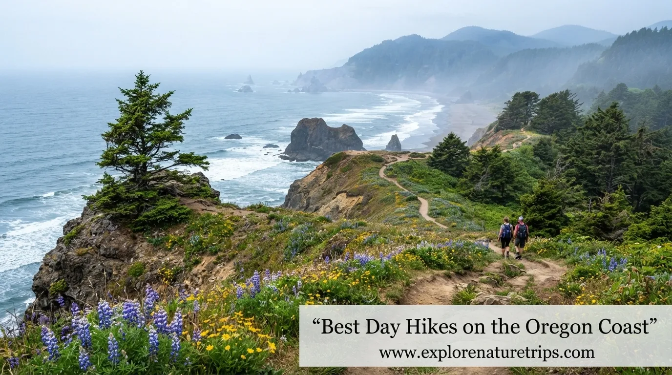
Best Day Hikes on the Oregon Coast
The Oregon Coast is one of those places where a short hike can lead to a dramatic ocean viewpoint, a hidden beach, a waterfall, or a forest-covered summit. The best day hikes on the Oregon Coast range from easy 0.5-mile walks to strenuous climbs with more than 2,500 feet of elevation gain.
This guide brings together the most useful trail information in one place, including distance, elevation, difficulty, trail type, scenery, seasonal considerations, parking, dogs, tides, and safety. Whether you want a quick coastal walk or a demanding half-day adventure, these trails offer plenty of ways to experience Oregon’s coastline.
Best Day Hikes on the Oregon Coast: 20 Scenic Trails to Explore — Keep Reading Below, You Won’t Want to Skip a Single Trail on This List!
1. Natural Bridges and Secret Beach
Southern Oregon’s coastline becomes especially dramatic around Natural Bridges, where rocky formations, ocean cliffs, and secluded coastal scenery create one of the most memorable hiking areas.
The Natural Bridges Viewpoint Trail is only 0.7 miles with approximately 62 feet of elevation gain, making it a good choice when you want impressive scenery without a long hike.
A separate Natural Bridges and Secret Beach route can cover about 1.5 miles with roughly 400 feet of elevation gain.
What makes it special
- Dramatic Pacific Ocean views
- Natural rock formations
- Short viewpoint options
- Secret Beach nearby
- Excellent photography opportunities
Safety matters here: some unofficial routes around Natural Bridges have dangerous cliff exposure. Stick to established viewpoints and obey closure signs rather than attempting unstable paths.
2. Devil’s Punchbowl
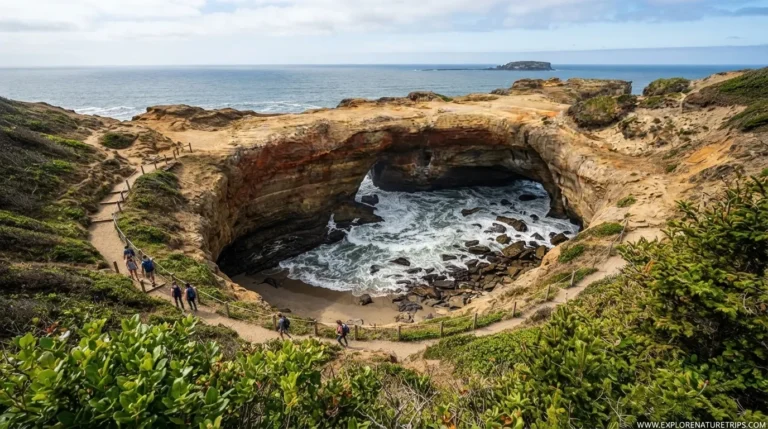
Devil’s Punchbowl near Otter Rock is one of the Oregon Coast’s most recognizable geological features. The short approach makes it accessible, but the experience changes significantly with the tide.
The hike can be around 0.5 to 1 mile, depending on the route, with approximately 100 feet of elevation gain.
The important part: check the tide
If you plan to enter the Punchbowl, low tide is essential. One recommendation is to arrive 30–60 minutes before low tide, with the tide ideally at or below 0 feet for entering the formation.
Never assume a route is safe simply because other visitors are using it. Waves can arrive unexpectedly, and wet rocks can become extremely slippery.
3. Short Sand Beach
Short Sand Beach is a particularly good choice if you want a relatively easy combination of forest and coastline.
The trail is approximately 1.2 miles round trip, with about 82–100 feet of elevation gain.
The route takes you through a forested environment before opening toward the beach, making it feel more substantial than its mileage suggests.
Good to know
The parking area can become busy, so arriving around 10 AM or earlier is a useful strategy if you want a better chance of finding parking and enjoying the trail before peak crowds.
4. Cape Falcon Trail
Cape Falcon is one of the classic northern Oregon Coast hikes.
The trail covers approximately 4.6 miles round trip and gains around 623 feet. It is generally considered moderate.
The route combines forest hiking with spectacular coastal viewpoints, making it a strong option when you want more than a simple beach walk.
Why hike Cape Falcon?
- 4.6-mile round trip
- 623 feet elevation gain
- Moderate difficulty
- Forest and ocean scenery
- Excellent viewpoint opportunities
5. Neahkahnie Mountain
For hikers who want a higher viewpoint, Neahkahnie Mountain offers a more demanding climb.
Depending on the route, the hike is approximately 3 or 5 miles, with about 900–1,300 feet of elevation gain.
The summit reaches roughly 1,600 feet, providing expansive views over the Pacific Ocean.
Best for
This is a good choice for hikers who want a mountain-style climb while remaining close to the coast.
Expect steeper sections than on many beach-oriented trails, so comfortable hiking shoes and sufficient water are worthwhile.
6. God’s Thumb via The Knoll
God’s Thumb is among the most photographed coastal hikes near Lincoln City.
Depending on the route and source, the hike is approximately 4.3–4.7 miles, with around 1,000–1,131 feet of elevation gain.
It is generally rated moderate, although some hikers consider the terrain more demanding than the official rating suggests.
What you’ll experience
The route passes through The Knoll before reaching the distinctive headland known as God’s Thumb. The combination of green coastal hills and open ocean makes this one of the standout viewpoints on the coast.
Safety tip
Avoid the route after heavy rainfall. Muddy conditions can make exposed sections considerably more difficult.
7. Drift Creek Falls Trail
Drift Creek Falls offers something different from many Oregon Coast hikes: a forest waterfall and a large suspension bridge.
Depending on the access and route described, the hike is approximately 2.6–3 miles, with elevation gain ranging from about 462 to 800 feet.
The suspension bridge stretches approximately 250 feet across the canyon.
Best seasons
Spring and winter can be especially rewarding because increased water flow can make the waterfall more impressive.
If you prefer a combination of forest scenery, a waterfall, and a memorable structure, this is one of the strongest choices.
8. Cape Lookout Trail
Cape Lookout is a classic 5-mile round-trip hike with approximately 900 feet of elevation gain.
The moderate trail travels through coastal forest toward a dramatic ocean-facing viewpoint.
Why put it on your list?
The combination of:
- 5 miles of hiking
- 900 feet of elevation gain
- Forest scenery
- Ocean views
- A dramatic coastal destination
makes Cape Lookout a rewarding half-day hike.
9. Cascade Head
Cascade Head provides a more substantial climb with excellent coastal scenery.
The trail is approximately 4.5 miles and gains around 1,200 feet, placing it firmly in the moderate category.
The elevated viewpoint is the main attraction, with broad views over the coastline and surrounding landscape.
Seasonal note
The Upper Trail has a seasonal access period described as July 16 through December 31, so check current access information before planning your trip.
10. Saint Perpetua Trail
Near Cape Perpetua, the Saint Perpetua Trail provides a rewarding climb toward elevated coastal viewpoints.
The trail is approximately 2.6–2.7 miles round trip and gains around 800–820 feet.
At the viewpoint, you can see a broad section of the Oregon coastline from above.
Quick stats
Distance: 2.6–2.7 miles
Elevation: 800–820 ft
Difficulty: Moderate
Best feature: Elevated ocean views
This is an excellent choice if you want a moderate hike without committing to a 5+ mile route.
11. Heceta Head to Hobbit Beach
The Heceta Head and Hobbit Beach area combines two iconic coastal attractions.
The longer route between Heceta Head Lighthouse and Hobbit Beach is approximately 3.6 miles round trip, with about 1,003 feet of elevation gain.
A shorter Hobbit Beach option is available if you don’t want the full hike.
Why it’s worth considering
You get a mixture of:
- Coastal forest
- Lighthouse scenery
- Ocean views
- Beach access
- Around 1,000 feet of climbing
The cliffs around Heceta Head reach approximately 200 feet, adding to the dramatic character of the landscape.
12. Cathedral Tree Trail
Located near Astoria, Cathedral Tree Trail offers a relatively short forest adventure.
The trail is approximately 1.6 miles round trip with 393 feet of elevation gain and is considered easy.
The major attraction is a huge Sitka spruce estimated at around 300 years old.
Best for
This is a good option for hikers who want:
- A short route
- Forest scenery
- Large old-growth trees
- A relatively manageable elevation gain
It can also work well as part of a broader northern Oregon Coast road trip.
13. Elk Flats Trail
Elk Flats Trail is another relatively short northern coast option.
The route is approximately 2.9 miles with around 616 feet of elevation gain and is generally considered moderate.
It provides a useful middle ground between very short viewpoint walks and longer mountain-style hikes.
14. Cape Meares
Cape Meares offers several ways to explore the area, with routes ranging from approximately 0.5 to 3 miles.
Elevation gain is generally minimal to around 200 feet, depending on the route.
Highlights
- Cape Meares Lighthouse
- Coastal viewpoints
- Forest
- Big Spruce
- Accessible short walks
The Cape Meares Lighthouse is approximately 38 feet tall, while the famous Big Spruce is estimated to be around 800 years old.
Because multiple short routes are available, Cape Meares works particularly well for visitors with different fitness levels.
15. Rockaway Big Tree Trail
If you want a short and easy nature experience, Rockaway Big Tree Trail deserves attention.
The trail is approximately 1.2 miles with minimal elevation gain.
Its main attraction is the enormous Rockaway Big Tree, estimated to be approximately 154 feet tall and around 1,000 years old.
Why families may like it
There is very little elevation to deal with, and the trail focuses more on experiencing the forest than completing a strenuous climb.
It is also identified as one of the more barrier-free options among the featured coastal hikes.
16. The Knoll and Thumb
The Knoll and Thumb can be approached as approximately 3 or 4.8 miles, depending on the route.
Elevation gain is around 650–1,100 feet, with difficulty generally classified as moderate.
The Knoll is particularly useful as a viewpoint and photography stop before continuing toward God’s Thumb.
Sunrise idea
If you’re comfortable starting early, sunrise can provide especially attractive light over the coastline.
17. Saddle Mountain
Saddle Mountain is not directly on the shoreline, but it is one of the notable hikes in the Oregon Coast Range.
The route is approximately 5.2 miles with around 1,900 feet of elevation gain and is rated moderate.
The trail is particularly noted for wildflowers in June, making early summer a great time to consider the hike.
Who should hike it?
Choose Saddle Mountain if you prefer a steeper climb and mountain scenery over an easy beach walk.
18. Kings Mountain
Kings Mountain is the serious climb on this list.
The hike is approximately 5 miles with about 2,545 feet of elevation gain and is classified as very strenuous.
A particularly demanding section gains approximately 2,500 feet in only 2.5 miles.
This is not a casual coastal stroll. It is better suited to hikers who are prepared for sustained elevation gain and challenging terrain.
Difficulty comparison
The Coast Range difficulty framework can help put it into perspective:
| Level | Typical Distance | Elevation Gain |
| Easy | Up to 6 mi | Up to 1,000 ft |
| Moderate | Up to 8 mi | 1,000–2,000 ft |
| Strenuous | Up to 10 mi | 2,000–3,000 ft |
| Very Strenuous | Up to 12 mi | 3,000–4,000 ft |
Using this framework, Kings Mountain clearly falls into the very strenuous category.
19. Cape Sebastian
Cape Sebastian offers a roughly 4-mile moderate hike descending from higher ground toward the beach.
The elevation change makes this hike feel considerably different from a flat coastal walk.
One important practical consideration is the access road toward Whaleshead Beach and similar southern coastal locations: some routes can be rough enough that 4×4/AWD vehicles are recommended.
20. Whaleshead Beach
Whaleshead Beach is a relatively easy coastal option where the hiking experience is strongly connected to the beach itself.
The walk can cover approximately 1–2 miles, depending on how far you explore.
What makes it different?
Instead of focusing on a major summit or waterfall, this hike is about:
- Beach scenery
- Ocean views
- Exploring the shoreline
- A relaxed coastal experience
It’s a good choice when you want something less demanding than a 4–5 mile mountain climb.
Choosing the Right Oregon Coast Hike
Not every beautiful trail is right for every hiking day. Your best choice depends on how much time you have, how much elevation you’re comfortable climbing, and whether you want forest, beach, waterfalls, or viewpoints.
Best easy hikes
Consider:
- Otter Point — 0.5 mi
- Natural Bridges Viewpoint — 0.7 mi
- Sisters Rock — 0.9 mi
- Short Sand Beach — 1.2 mi
- Rockaway Big Tree — 1.2 mi
- Cathedral Tree — 1.6 mi
These are useful when you have limited time or want a less physically demanding outing.
Best moderate hikes
For a stronger workout, consider:
- Cape Falcon — 4.6 mi
- God’s Thumb — 4.3–4.7 mi
- Cascade Head — 4.5 mi
- Cape Lookout — 5 mi
- Neahkahnie Mountain — 3–5 mi
- Saint Perpetua — 2.6–2.7 mi
Best challenging hikes
If elevation is what you’re looking for:
- Saddle Mountain — 1,900 ft gain
- Kings Mountain — 2,545 ft gain
Kings Mountain is the clear choice for experienced hikers seeking a very strenuous climb.
Best Oregon Coast Hikes by Experience
| If you want… | Try… |
| A very short walk | Otter Point |
| A quick viewpoint | Natural Bridges |
| A beach hike | Short Sand Beach |
| A waterfall | Drift Creek Falls |
| A lighthouse | Heceta Head |
| A giant tree | Rockaway Big Tree |
| A dramatic headland | God’s Thumb |
| A mountain summit | Neahkahnie Mountain |
| Wildflowers | Saddle Mountain |
| A serious workout | Kings Mountain |
| Hidden coastal scenery | Secret Beach |
| Forest + ocean | Cape Falcon |
| Sunrise photography | The Knoll / God’s Thumb |
When Is the Best Time to Hike the Oregon Coast?
Summer is traditionally the most popular season, but fall can be an excellent alternative.
September and October can offer:
- Temperatures around the 50s
- Fewer visitors
- More peaceful trails
- Attractive fall conditions
However, Oregon’s coastal weather can change quickly. Rain can make forest trails muddy and exposed terrain slippery.
Spring
Spring can be particularly good for waterfalls because higher water flow can improve the experience at places such as Drift Creek Falls.
Winter
Winter can offer quieter trails but requires greater caution because of rain, wind, mud, and changing trail conditions.
Summer
Summer generally offers the most popular hiking conditions, but expect more visitors and busier parking areas.
Tide Safety on Coastal Hikes
Some Oregon Coast hikes are not simply hiking trails—they are tide-dependent adventures.
Devil’s Punchbowl and several beach routes require you to understand the tide before leaving.
Before entering a beach or rock formation
Check:
- The day’s low-tide time.
- The predicted tide height.
- Weather and wave conditions.
- Whether the route is officially open.
- Whether you have enough time to return before the tide rises.
For Devil’s Punchbowl, one recommendation is to arrive 30–60 minutes before low tide, with a tide at or below 0 feet for entering the Punchbowl.
Never rely solely on another person’s timing. Ocean conditions can change, and a route that looks safe can become dangerous quickly.
Dogs, Accessibility and Trail Passes
Trail rules differ considerably across the Oregon Coast.
Some trails allow dogs on leash, while others have different restrictions. For example, God’s Thumb is described as dog-friendly when leashed, and Fort to Sea also allows dogs.
Accessibility also varies. Cape Meares and Rockaway Big Tree are among the areas offering easier or more accessible options, while some viewpoints and longer trails have terrain limitations.
Pass information
The mentions:
- Oregon State Park Pass: $5/day in one source
- Another source lists a state park pass at $10/day
- NW Forest Pass: $5/day
Because fees and pass requirements can change, verify the current requirement for the specific trailhead before your trip.
How to Plan an Oregon Coast Hiking Day
A little planning can make a major difference.
1. Check the trail status
Some trails or sections can close because of landslides, erosion, weather, or other hazards.
Ecola State Park, for example, has had changing access conditions, including a reopening for day use in April 2026 while a western section of the Clatsop Loop Trail remained closed because of a landslide.
2. Start early
Popular trailheads and beach parking areas can fill quickly.
For Short Sand Beach, arriving around 10 AM or earlier is recommended.
3. Check the tide
This is especially important for beach-access routes and Devil’s Punchbowl.
4. Bring rain protection
Even when the forecast looks favorable, coastal weather can shift quickly. A lightweight rain jacket is useful, especially during fall, winter, and spring.
5. Don’t underestimate elevation
A 4.5-mile trail with 1,200 feet of elevation gain is very different from a flat 4.5-mile beach walk.
Look at both distance and elevation gain before deciding whether a trail fits your ability.
How Long Should You Spend on an Oregon Coast Hike?
The amount of time needed depends on the trail and your pace.
| Hiking Style | Suitable Trails |
| 1–2 hour outing | Otter Point, Natural Bridges, Sisters Rock |
| 2–3 hour hike | Short Sand Beach, Drift Creek Falls, Saint Perpetua |
| 3–4 hour adventure | Cape Falcon, God’s Thumb, Cascade Head |
| Half-day challenge | Cape Lookout, Saddle Mountain |
| Serious mountain hike | Kings Mountain |
Ecola State Park’s longer trail sections can require approximately 2–3 hours before sunset, depending on the route and pace.
Oregon Coast Hiking Road Trip Tips
A car is generally the easiest way to reach many of these trailheads.
For visitors arriving from Portland, one common route is:
Portland → Highway 26 → Oregon Coast → Highway 101
Portland International Airport (PDX) is a practical starting point for travelers flying into the region and planning a coastal road trip.
Because the Oregon Coast stretches a long distance from north to south, trying to visit every trail in one day isn’t realistic.
Instead, group hikes geographically.
Northern Coast
Good options include:
- Cathedral Tree
- Short Sand Beach
- Cape Falcon
- Elk Flats
- Neahkahnie Mountain
- Cape Meares
Central Coast
Consider:
- Devil’s Punchbowl
- God’s Thumb
- Cape Lookout
- Cascade Head
- Drift Creek Falls
- Saint Perpetua
- Heceta Head
Southern Coast
Explore:
- Sisters Rock
- Secret Beach
- Natural Bridges
- Otter Point
- Cape Sebastian
- Indian Sands
This approach reduces unnecessary driving and lets you spend more time on the trails.
What to Pack for Oregon Coast Day Hikes
The coast isn’t the place to assume conditions will stay perfect all day.
A practical day-hiking setup includes:
- Water
- Rain jacket
- Comfortable hiking shoes
- Extra layer
- Navigation/phone
- Snacks
- Small first-aid kit
- Sun protection
- Tide information when visiting beaches
- Headlamp for longer hikes
For muddy or wet conditions, footwear with good traction is particularly important.
Important Safety Rules
The Oregon Coast is beautiful, but cliffs, tides, slippery rocks, and changing weather deserve respect.
Keep these rules in mind
Stay on official trails.
Don’t follow unofficial cliffside routes simply because they appear on social media.
Respect closures.
If signs say a route is closed, turn around.
Watch the ocean.
Never turn your back on incoming waves when you’re near rocks or exposed shoreline.
Avoid wet cliff edges.
Rain can make already-steep terrain unstable.
Tell someone your plan.
For longer or remote hikes, let someone know your route and expected return time.
Carry enough water.
Even moderate hikes can become difficult when combined with steep elevation gain.
Final Trail Selection Cheat Sheet
If you only have time for a few hikes, your choice can be simple:
For an easy adventure: choose Short Sand Beach or Sisters Rock.
For a waterfall: choose Drift Creek Falls.
For dramatic ocean views: choose God’s Thumb or Cape Falcon.
For a lighthouse: choose Heceta Head or Cape Meares.
For a mountain challenge: choose Neahkahnie Mountain or Saddle Mountain.
For a serious workout: choose Kings Mountain.
For tide-dependent scenery: choose Devil’s Punchbowl, but plan around low tide.
For a short southern-coast viewpoint: choose Natural Bridges or Otter Point.
Frequently Asked Questions
What is the best day hike on the Oregon Coast?
There isn’t one perfect trail for everyone. God’s Thumb, Cape Falcon, Cape Lookout, and Cascade Head are strong choices for hikers who want substantial coastal scenery, while Natural Bridges and Sisters Rock work better for shorter outings.
What is the easiest Oregon Coast hike?
Some of the shortest and easiest options include Otter Point at 0.5 miles, Natural Bridges Viewpoint at 0.7 miles, and Sisters Rock at approximately 0.9 miles.
Which Oregon Coast hike has the best ocean views?
God’s Thumb, Cape Falcon, Cascade Head, Cape Lookout, and Neahkahnie Mountain all provide excellent elevated coastal views.
What Oregon Coast hike has a waterfall?
Drift Creek Falls is one of the standout waterfall hikes. The route is approximately 2.6–3 miles, depending on the route, and includes a suspension bridge of about 250 feet.
Is Devil’s Punchbowl safe at high tide?
You should not plan to enter the Punchbowl at high tide. The route is tide-dependent, and entering is recommended only around suitable low-tide conditions. Check the tide and ocean conditions before going.
What is the hardest hike in this guide?
Kings Mountain is the most demanding, with approximately 5 miles of distance and 2,545 feet of elevation gain. A major section climbs roughly 2,500 feet in 2.5 miles.
What is the best season for Oregon Coast hiking?
Summer is the most popular, but September and October can be excellent for fewer crowds and temperatures around the 50s. Spring is particularly attractive for waterfall hikes because of higher water flow.
Do you need a car for Oregon Coast hikes?
For many trailheads, yes. The hiking areas are spread along the coast, and a car makes it much easier to combine multiple trails and reach remote trailheads.
Can I take my dog hiking?
Some trails allow dogs, often on leash, but rules vary by location. Always check the current regulations for the specific park or trail before arriving.
Are Oregon Coast trails suitable for beginners?
Yes. There are numerous beginner-friendly trails under 2 miles, including Otter Point, Natural Bridges, Sisters Rock, Short Sand Beach, and Rockaway Big Tree. Beginners should choose based on both distance and elevation rather than distance alone.
Conclusion
The best day hikes on the Oregon Coast aren’t limited to one type of landscape. You can walk 0.5 miles to a dramatic viewpoint, explore a 1.2-mile forest trail to an ancient tree, climb 1,900 feet toward Saddle Mountain, or take on the 2,545-foot ascent of Kings Mountain. The key is matching the trail to your fitness level, available time, weather, and interests.
Before setting out, check trail status, tides, weather, parking, closures, and current regulations. With the right preparation, the Oregon Coast offers an exceptional mix of beaches, forests, waterfalls, cliffs, viewpoints, and unforgettable day hikes.

Hi, I’m Marcus! I love exploring the outdoors and discovering incredible places. Through ExploreNatureTrips blog, I share my travel experiences, useful tips, and recommendations for the best sights, trails, and destinations to visit.




3 Comments